Jump to content

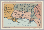
File:West Florida Map 1767.jpg

Page contents not supported in other languages.
This is a file from the Wikimedia Commons
From Wikipedia, the free encyclopedia

West_Florida_Map_1767.jpg (448 × 280 pixels, file size: 33 KB, MIME type: image/jpeg)

Summary

From English Wiki: Map of West Florida in 1767. Cropped from map at [1]. Perry-Castañeda Library Map Collection.

.

Licensing

Public domain

This work is in the public domain in its country of origin and other countries and areas where the copyright term is the author's life plus 70 years or fewer.


You must also include a United States public domain tag to indicate why this work is in the public domain in the United States.

Captions

Add a one-line explanation of what this file represents

Items portrayed in this file

depicts

image/jpeg

File history

Click on a date/time to view the file as it appeared at that time.

Date/TimeThumbnailDimensionsUserComment
current23:45, 18 November 2005Thumbnail for version as of 23:45, 18 November 2005448 × 280 (33 KB)Jan KronsellFrom English Wiki: Map of West Florida in 1767. Cropped from map at [1]. Perry-Castañeda Library Map Collection. Category: Maps {{PD}}
No pages on the English Wikipedia use this file (pages on other projects are not listed).

Metadata