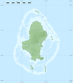
File:Wallis relief location map.png
Appearance

Size of this preview: 531 × 600 pixels. Other resolutions: 212 × 240 pixels | 425 × 480 pixels | 680 × 768 pixels | 1,082 × 1,222 pixels.
Original file (1,082 × 1,222 pixels, file size: 208 KB, MIME type: image/png)
File history
Click on a date/time to view the file as it appeared at that time.
| Date/Time | Thumbnail | Dimensions | User | Comment | |
|---|---|---|---|---|---|
| current | 21:19, 18 July 2010 |  | 1,082 × 1,222 (208 KB) | Sting | Color profile |
| 02:25, 11 July 2010 |  | 1,082 × 1,222 (210 KB) | Sting | Simplifying reef color scheme | |
| 22:06, 10 July 2010 |  | 1,082 × 1,222 (231 KB) | Sting | == {{int:filedesc}} == {{Location|13|17|15|S|176|12|00|W|scale:100000}} <br/> {{Information |Description={{en|Blank physical map of Wallis Island, part of the French overseas collectivity of [[:en |
File usage
The following 3 pages use this file:
Global file usage
The following other wikis use this file:
- Usage on ar.wikipedia.org
- Usage on be-tarask.wikipedia.org
- Usage on bg.wikipedia.org
- Usage on ceb.wikipedia.org
- Usage on de.wikipedia.org
- Usage on el.wikipedia.org
- Usage on eo.wikipedia.org
- Usage on fa.wikipedia.org
- Usage on fr.wikipedia.org
- Mata-Utu
- Hahake
- Nukuloa
- Lac Lalolalo
- Projet:Cartographie/Cartes standards/France
- Modèle:Géolocalisation/Wallis
- Modèle:Géolocalisation/Wallis/Documentation
- Modèle:Géolocdual/Wallis
- Wikipédia:Atelier graphique/Cartes/Archives/juillet 2010
- Nukuteatea
- Nukutapu
- Nukuhifala
- Nukufotu
- Nukuatea
- Luaniva
- Fugalei
- Fenuafo'ou
- Vailala
- Hihifo
- Mu'a (Wallis)
- Aka'aka
- Ahoa
- Mala'efo'ou
- Liku (Wallis-et-Futuna)
- Falaleu
- Ha'afuasia
- Alele
- Vaitupu (Wallis-et-Futuna)
- Mala'e (Wallis)
- Tufu'one
- Halalo
- Utufua
- Vaimalau
- Lavegahau
- Te'esi
- Gahi
- Tepa (Wallis-et-Futuna)
- Ha'atofo
- Kolopopo
- Nukuhione
View more global usage of this file.


