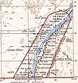
File:Wadi Halfa Salient-txu-oclc-6949452-nf36-5 crop.jpg
Appearance

Size of this preview: 566 × 599 pixels. Other resolutions: 227 × 240 pixels | 453 × 480 pixels | 786 × 832 pixels.
Original file (786 × 832 pixels, file size: 197 KB, MIME type: image/jpeg)
File history
Click on a date/time to view the file as it appeared at that time.
| Date/Time | Thumbnail | Dimensions | User | Comment | |
|---|---|---|---|---|---|
| current | 03:08, 15 July 2014 |  | 786 × 832 (197 KB) | Beyond My Ken | == {{int:filedesc}} == {{Information |Description={{en|1=North Africa 1:250,000 Sheet NF 36-5 in the southeast is the Wadi Halfa Salient, with the situation before the flooding by the Aswan Dam and Lake Nasser }} |Source=http://www.lib.utexas.edu/maps/... |
File usage
The following page uses this file:
Global file usage
The following other wikis use this file:
- Usage on ar.wikipedia.org
- Usage on ja.wikipedia.org


