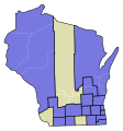
File:WI Senate Partisan Map 1848.svg
Appearance

Size of this PNG preview of this SVG file: 245 × 262 pixels. Other resolutions: 224 × 240 pixels | 449 × 480 pixels | 718 × 768 pixels | 958 × 1,024 pixels | 1,915 × 2,048 pixels.
Original file (SVG file, nominally 245 × 262 pixels, file size: 31 KB)
File history
Click on a date/time to view the file as it appeared at that time.
| Date/Time | Thumbnail | Dimensions | User | Comment | |
|---|---|---|---|---|---|
| current | 22:02, 22 August 2021 |  | 245 × 262 (31 KB) | Asdasdasdff | Correcting Manitowoc county boundaries, other technical fixes |
| 21:37, 21 August 2021 |  | 245 × 262 (31 KB) | Asdasdasdff | fixed some boundaries and made technical improvements | |
| 20:02, 17 January 2021 |  | 454 × 489 (61 KB) | Asdasdasdff | transparency | |
| 20:00, 17 January 2021 |  | 454 × 489 (61 KB) | Asdasdasdff | transparency in 2 counties | |
| 19:52, 17 January 2021 |  | 454 × 489 (60 KB) | Asdasdasdff | problem with 1 district | |
| 19:44, 17 January 2021 |  | 454 × 489 (60 KB) | Asdasdasdff | missed a district boundary on previous ver | |
| 19:36, 17 January 2021 |  | 454 × 489 (60 KB) | Asdasdasdff | Uploaded own work with UploadWizard |
File usage
The following page uses this file:
