File:VictoriaIslandMap.png
Appearance
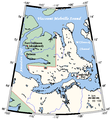
VictoriaIslandMap.png (504 × 540 pixels, file size: 27 KB, MIME type: image/png)
File history
Click on a date/time to view the file as it appeared at that time.
| Date/Time | Thumbnail | Dimensions | User | Comment | |
|---|---|---|---|---|---|
| current | 01:53, 31 January 2021 |  | 504 × 540 (27 KB) | Kelisi | Oops! That was silly. Sorry, I'll try again.......... |
| 01:50, 31 January 2021 |  | 504 × 540 (27 KB) | Kelisi | Inhabited hamlets' names have been rendered in bigger type (Fort Collinson has been left smaller), and the local name Ulukhaktok has replaced the former, English name Holman, since the article about the place now has that title. | |
| 11:32, 13 August 2008 |  | 504 × 540 (21 KB) | Telim tor | == Information == {{Information |Description={{en|A map Victoria Island, Canada}} |Source=This map's source is [http://www.aquarius.ifm-geomar.de/ here], with the uploader's modifications, and the [http://gmt.soest.hawaii.edu/ GMT homepage] says that the |
File usage
The following 3 pages use this file:
Global file usage
The following other wikis use this file:
- Usage on af.wikipedia.org
- Usage on bg.wikipedia.org
- Usage on bs.wikipedia.org
- Usage on ca.wikipedia.org
- Usage on ckb.wikipedia.org
- Usage on da.wikipedia.org
- Usage on eo.wikipedia.org
- Usage on es.wikipedia.org
- Usage on fa.wikipedia.org
- Usage on gl.wikipedia.org
- Usage on hu.wikipedia.org
- Usage on ilo.wikipedia.org
- Usage on nn.wikipedia.org
- Usage on no.wikipedia.org
- Usage on pl.wikipedia.org
- Usage on ro.wikipedia.org
- Usage on th.wikipedia.org
- Usage on tt.wikipedia.org
- Usage on uk.wikipedia.org
- Usage on www.wikidata.org
- Usage on zh.wikipedia.org


