
File:Thessaloniki Fire 1917 Map.jpg
Size of this preview: 540 × 600 pixels. Other resolutions: 216 × 240 pixels | 432 × 480 pixels | 685 × 761 pixels.
Original file (685 × 761 pixels, file size: 157 KB, MIME type: image/jpeg)
| This is a file from the Wikimedia Commons. Information from its description page there is shown below. Commons is a freely licensed media file repository. You can help. |
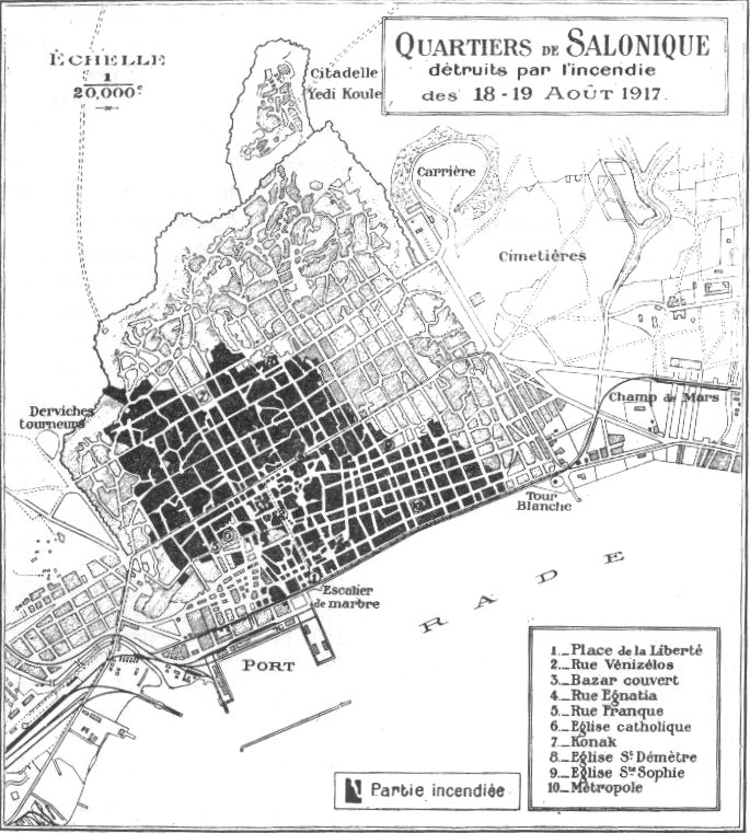
| Description | Map of Thessaloniki during the Great Fire - 1917 |
| Date | |
| Source | taken from en:Great Fire of Thessaloniki |
| Author | Unknown author |
|
This work is in the public domain in its country of origin and other countries and areas where the copyright term is the author's life plus 70 years or fewer. | |
| This file has been identified as being free of known restrictions under copyright law, including all related and neighboring rights. | |
File history
Click on a date/time to view the file as it appeared at that time.
| Date/Time | Thumbnail | Dimensions | User | Comment | |
|---|---|---|---|---|---|
| current | 19:03, 17 May 2007 | | 685 × 761 (157 KB) | Aeleftherios | {{Information |Description=Map of Thessaloniki during the Great Fire - 1917 |Source=taken from en:Great Fire of Thessaloniki |Date=1917 |Author=unknown |Permission= |other_versions= }} {{PD-OLD}} category:Thessaloniki |
File usage
The following pages on the English Wikipedia use this file (pages on other projects are not listed):
Global file usage
The following other wikis use this file:
- Usage on be.wikipedia.org
- Usage on bg.wikipedia.org
- Usage on ca.wikipedia.org
- Usage on de.wikipedia.org
- Usage on el.wikipedia.org
- Usage on es.wikipedia.org
- Usage on fr.wikipedia.org
- Usage on gl.wikipedia.org
- Usage on hyw.wikipedia.org
- Usage on it.wikipedia.org
- Usage on ru.wikipedia.org
- Usage on sr.wikipedia.org
- Usage on tr.wikipedia.org
- Usage on www.wikidata.org