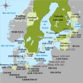
File:Swedish Empire (1560-1815) es.svg
Appearance

Size of this PNG preview of this SVG file: 604 × 600 pixels. Other resolutions: 242 × 240 pixels | 483 × 480 pixels | 773 × 768 pixels | 1,031 × 1,024 pixels | 2,062 × 2,048 pixels | 734 × 729 pixels.
Original file (SVG file, nominally 734 × 729 pixels, file size: 728 KB)
File history
Click on a date/time to view the file as it appeared at that time.
| Date/Time | Thumbnail | Dimensions | User | Comment | |
|---|---|---|---|---|---|
| current | 22:28, 26 June 2020 |  | 734 × 729 (728 KB) | Rowanwindwhistler | Minor change |
| 09:22, 26 June 2020 |  | 434 × 431 (716 KB) | Rowanwindwhistler | Zoomed in, colour legend removed (now in file description), new font, lighter colours for territories. | |
| 12:11, 21 June 2018 |  | 433 × 531 (736 KB) | Srittau | Reverted to version as of 09:26, 19 June 2018 (UTC) | |
| 12:03, 21 June 2018 |  | 433 × 531 (746 KB) | Srittau | Reverted to version as of 10:21, 26 September 2016 (UTC) | |
| 09:26, 19 June 2018 |  | 433 × 531 (736 KB) | Vertem | Corrección error ortográfico grave. | |
| 10:21, 26 September 2016 |  | 433 × 531 (746 KB) | Rowanwindwhistler | Error corrected (duplicated text) | |
| 10:19, 26 September 2016 |  | 433 × 531 (719 KB) | Rowanwindwhistler | https://wiki.riteme.site/wiki/Wikipedia:WikiProject_Maps/Conventions Real text hidden, fake text added | |
| 10:17, 7 August 2015 |  | 433 × 531 (225 KB) | Rowanwindwhistler | User created page with UploadWizard |
File usage
The following page uses this file:
Global file usage
The following other wikis use this file:
- Usage on ast.wikipedia.org
- Usage on ca.wikipedia.org
- Usage on es.wikipedia.org
- Usage on eu.wikipedia.org
- Usage on no.wikipedia.org
- Usage on pt.wikipedia.org
- Usage on ro.wikipedia.org
- Usage on www.wikidata.org
