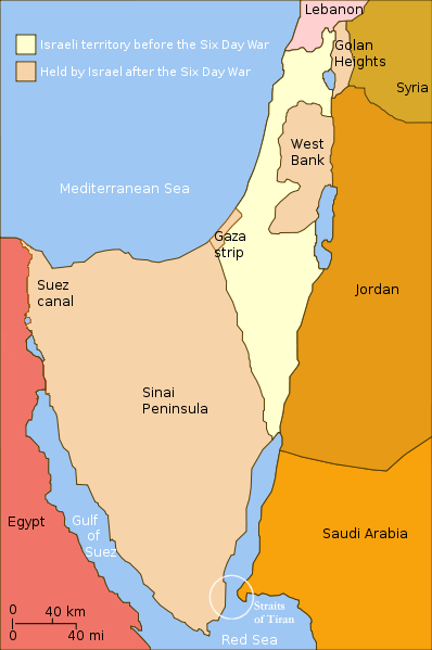
File:Six Day War Territories.png
Appearance
Six_Day_War_Territories.png (398 × 599 pixels, file size: 53 KB, MIME type: image/png)
File history
Click on a date/time to view the file as it appeared at that time.
| Date/Time | Thumbnail | Dimensions | User | Comment | |
|---|---|---|---|---|---|
| current | 21:32, 11 November 2010 |  | 398 × 599 (53 KB) | 99of9 | Reverted to version as of 07:04, 25 July 2010. Both POV versions should be at different locations, marked with POV and linked. |
| 11:06, 8 November 2010 |  | 398 × 599 (52 KB) | Supreme Deliciousness | Israeli territory before the Six day war is the same as after the Six day war. | |
| 07:04, 25 July 2010 |  | 398 × 599 (53 KB) | Ling.Nut | {{Information |Description={{en|1=Israeli territories before and after the Six Day War. The Straits of Tiran are circled, between the Gulf of Aqaba, and the Red Sea.}} |Source=Yom Kippur War map.svg |Author=User:Ling.Nut |Date= |Permission= |other_ver |
File usage
No pages on the English Wikipedia use this file (pages on other projects are not listed).
Global file usage
The following other wikis use this file:
- Usage on ca.wikipedia.org
- Usage on he.wikipedia.org
- Usage on nl.wikipedia.org
- Usage on ug.wikipedia.org
- Usage on www.wikidata.org


