File:Savarivermap.png
Appearance
Savarivermap.png (287 × 287 pixels, file size: 37 KB, MIME type: image/png)
File history
Click on a date/time to view the file as it appeared at that time.
| Date/Time | Thumbnail | Dimensions | User | Comment | |
|---|---|---|---|---|---|
| current | 12:58, 17 December 2013 |  | 287 × 287 (37 KB) | Ras67 | cropped |
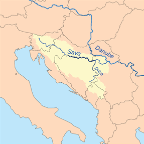
| 13:23, 8 February 2007 |  | 300 × 300 (52 KB) | Kmusser | This is a map of the Sava River watershed. I, Karl Musser, created it based on USGS data. {{self|cc-by-sa-2.5}} Category:Maps of rivers |
File usage
The following 3 pages use this file:
Global file usage
The following other wikis use this file:
- Usage on af.wikipedia.org
- Usage on am.wikipedia.org
- Usage on an.wikipedia.org
- Usage on ar.wikipedia.org
- Usage on ast.wikipedia.org
- Usage on azb.wikipedia.org
- Usage on az.wikipedia.org
- Usage on be-tarask.wikipedia.org
- Usage on br.wikipedia.org
- Usage on bs.wikipedia.org
- Zagreb
- Brčko
- Šamac
- Orašje
- Beograd
- Ljubljana
- Bosna (rijeka)
- Gradiška
- Una
- Vrbas
- Sava
- Geografija Bosne i Hercegovine
- Obrenovac
- Drina
- Posavina
- Slavonski Brod
- Ljubljanica (rijeka)
- Županja
- Bosut
- Tinja
- Geografija Hrvatske
- Sunja (rijeka)
- Sremska Mitrovica
- Sisak
- Kranj
- Sutla
- Orljava
- Kupa
- Šablon:Geokutija/vrsta/Rijeka
- Brka (rijeka)
- Ukrina
- Šabac
- Brežice
- Krško
- Litija
- Trbovlje
- Jesenice
- Šablon:Sava
- Geografija Slovenije
View more global usage of this file.

