
File:Salt Lake City-Provo-Orem CSA 2020.png
No higher resolution available.
Salt_Lake_City-Provo-Orem_CSA_2020.png (388 × 478 pixels, file size: 28 KB, MIME type: image/png)
Summary
[edit]| Description |
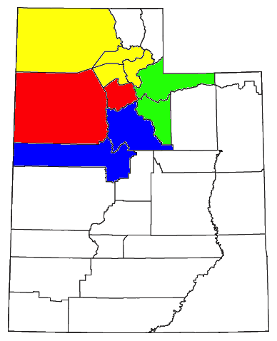
Locator map of the Salt Lake City-Provo-Orem Combined Statistical Area in the northern part of the U.S. state of Utah. The five components of the CSA are colored separately: | ||
|---|---|---|---|
| Source |
Modified from | ||
| Date |
2020-05-26 | ||
| Author | |||
| Permission (Reusing this file) |
US Government work is public domain, and my work is
|

File history
Click on a date/time to view the file as it appeared at that time.
| Date/Time | Thumbnail | Dimensions | User | Comment | |
|---|---|---|---|---|---|
| current | 23:53, 26 May 2020 | | 388 × 478 (28 KB) | Highway 89 (talk | contribs) | {{Information |Description=Locator map of the {{w|Salt Lake City–Provo–Orem Combined Statistical Area|Salt Lake City-Provo-Orem}} {{w|Combined Statistical Area}} in the northern part of the {{w|U.S. state}} of {{w|Utah}}. The five components of the CSA are colored separately: *{{w|Salt Lake City metropolitan area|Salt Lake City Metropolitan Statistical Area}}: red *{{w|Ogden-Clearfield metropolitan area|Ogden-Clearfield Metropolitan Statistical Area}}: yellow *{{w|Provo–Orem metropolitan are... |
You cannot overwrite this file.
File usage
The following page uses this file: