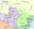
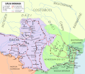
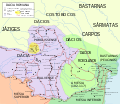
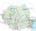
File:Roman province of Dacia (106 - 271 AD).svg
Appearance

Size of this PNG preview of this SVG file: 692 × 600 pixels. Other resolutions: 277 × 240 pixels | 554 × 480 pixels | 886 × 768 pixels | 1,182 × 1,024 pixels | 2,363 × 2,048 pixels | 1,500 × 1,300 pixels.
Original file (SVG file, nominally 1,500 × 1,300 pixels, file size: 392 KB)
File history
Click on a date/time to view the file as it appeared at that time.
| Date/Time | Thumbnail | Dimensions | User | Comment | |
|---|---|---|---|---|---|
| current | 11:44, 19 February 2019 |  | 1,500 × 1,300 (392 KB) | Caliniuc | Minor corrections and tweaks |
| 11:40, 19 February 2019 |  | 1,500 × 1,300 (392 KB) | Caliniuc | - Corrected placenames (Samus - Samum; Pons Yetus - Pons Vetus; Artutela - Arutela; Angusta - Angustia; Sextanta Prista - Sexaginta Prinsta); - Present-day placenames styled to italics; - Converted placenames from all-uppercase to initial-uppercase; - Added saliferous areas. | |
| 00:06, 20 January 2011 |  | 1,500 × 1,300 (377 KB) | ArdadN | 1 | |
| 04:49, 15 January 2011 |  | 1,500 × 1,300 (378 KB) | ArdadN | 1 | |
| 04:20, 15 January 2011 |  | 1,500 × 1,300 (381 KB) | ArdadN | 1 | |
| 04:08, 15 January 2011 |  | 1,500 × 1,300 (380 KB) | ArdadN | 1 | |
| 04:03, 15 January 2011 |  | 1,500 × 1,300 (380 KB) | ArdadN | 1 | |
| 17:29, 20 October 2008 |  | 1,500 × 1,300 (369 KB) | El bes | Reverted to version as of 20:20, 13 November 2007 | |
| 21:39, 19 October 2008 |  | 1,500 × 1,300 (430 KB) | ArdadN | {{Information |Description= |Source= |Date= |Author= |Permission= |other_versions= }} | |
| 21:16, 19 October 2008 |  | 1,500 × 1,300 (418 KB) | ArdadN | {{Information |Description= |Source= |Date= |Author= |Permission= |other_versions= }} |
File usage
The following 38 pages use this file:
- Argidava
- Carpi (people)
- Costoboci
- Dacia
- Dacian warfare
- Domitian
- Drobeta-Turnu Severin
- Free Dacians
- History of Christianity in Romania
- History of Maramureș
- History of Moldova
- History of Romania
- History of Transylvania
- Lipitsa culture
- Military history of Romania
- Roman Dacia
- Romania in Antiquity
- Romania in the Early Middle Ages
- Sarmizegetusa Regia
- Substrate in Romanian
- Timeline of Cluj-Napoca
- Trajan's Second Dacian War
- Viminacium
- User:Crbillet/sandbox
- User:Falcaorib/Ancient Empires (150-500 AD)
- User:Falcaorib/Iran
- User:Keb111/sandbox
- User:MGBarrett/sandbox
- User:Moniqua Roberts/sandbox
- User:Nccam/sandbox
- User:Neilee/sandbox
- User:Robinlatham/sandbox
- User:Shinglef/sandbox
- User:Slinkys/sandbox
- User:Volleys/sandbox
- User:Zebranih/sandbox
- Portal:Moldova
- Portal:Romania
Global file usage
The following other wikis use this file:
- Usage on ar.wikipedia.org
- Usage on bg.wikipedia.org
- Usage on ceb.wikipedia.org
- Usage on cs.wikipedia.org
- Usage on da.wikipedia.org
- Usage on de.wikipedia.org
- Usage on el.wikipedia.org
- Usage on et.wikipedia.org
- Usage on fa.wikipedia.org
- Usage on fr.wikipedia.org
- Usage on hr.wikipedia.org
- Usage on hu.wikipedia.org
- Usage on io.wikipedia.org
- Usage on it.wikipedia.org
- Usage on ja.wikipedia.org
- Usage on ka.wikipedia.org
- Usage on ko.wikipedia.org
View more global usage of this file.


