
File:Old Map Hursley 1607.jpg
No higher resolution available.
Old_Map_Hursley_1607.jpg (480 × 320 pixels, file size: 51 KB, MIME type: image/jpeg)
| This is a file from the Wikimedia Commons. Information from its description page there is shown below. Commons is a freely licensed media file repository. You can help. |
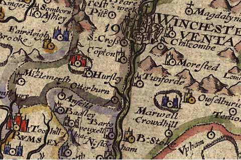
Map of Hursley from 1607
Source: http://www.envf.port.ac.uk/hantsgaz/refnos/nrd1su42.htm
|
This work is in the public domain in its country of origin and other countries and areas where the copyright term is the author's life plus 70 years or fewer. | |
| This file has been identified as being free of known restrictions under copyright law, including all related and neighboring rights. | |
File history
Click on a date/time to view the file as it appeared at that time.
| Date/Time | Thumbnail | Dimensions | User | Comment | |
|---|---|---|---|---|---|
| current | 11:39, 13 June 2005 | | 480 × 320 (51 KB) | ¡0-8-15! | Map of Hursley from 1607 '''Source:''' http://www.envf.port.ac.uk/hantsgaz/refnos/nrd1su42.htm {{PD-Old}} |
File usage
The following pages on the English Wikipedia use this file (pages on other projects are not listed):