
File:Mississippi River, Lee County, Iowa and the "Half Breed Tract" historic map detail, from- Iowa 1905 Census Map Indian Terr Accessions (cropped).jpg
No higher resolution available.
Mississippi_River,_Lee_County,_Iowa_and_the_"Half_Breed_Tract"_historic_map_detail,_from-_Iowa_1905_Census_Map_Indian_Terr_Accessions_(cropped).jpg (394 × 319 pixels, file size: 117 KB, MIME type: image/jpeg)
| This is a file from the Wikimedia Commons. Information from its description page there is shown below. Commons is a freely licensed media file repository. You can help. |
Summary
| Description |
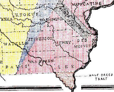
English: "Map Showing Accession of Territory from Indians" from the original instructions for the Census of Iowa for the Year 1905, Published: 1905-1906, Des Moines, Iowa, Bernard Murphy, State Printer; Under the authority of chapter 8, acts of the 30th general assembly, page iii |
| Date | |
| Source | http://iagenweb.org/census/1905/index.html |
| Author | Iowa State Executive Council for the Iowa Secretary of State |
| Other versions |

.jpg)
Licensing
This media file is in the public domain in the United States. This applies to U.S. works where the copyright has expired, often because its first publication occurred prior to January 1, 1929, and if not then due to lack of notice or renewal. See this page for further explanation.
|
 | |
 |
File history
Click on a date/time to view the file as it appeared at that time.
| Date/Time | Thumbnail | Dimensions | User | Comment | |
|---|---|---|---|---|---|
| current | 18:26, 17 August 2020 | | 394 × 319 (117 KB) | Tibet Nation | File:Iowa 1905 Census Map Indian Terr Accessions.jpg cropped 71 % horizontally, 65 % vertically using CropTool with lossless mode. |
File usage
The following pages on the English Wikipedia use this file (pages on other projects are not listed):
.jpg)