
File:Mideast1920.jpg
Size of this preview: 795 × 600 pixels. Other resolutions: 318 × 240 pixels | 636 × 480 pixels | 1,018 × 768 pixels | 1,280 × 966 pixels | 2,560 × 1,932 pixels | 3,992 × 3,012 pixels.
Original file (3,992 × 3,012 pixels, file size: 2.48 MB, MIME type: image/jpeg)
| This is a file from the Wikimedia Commons. Information from its description page there is shown below. Commons is a freely licensed media file repository. You can help. |
Summary
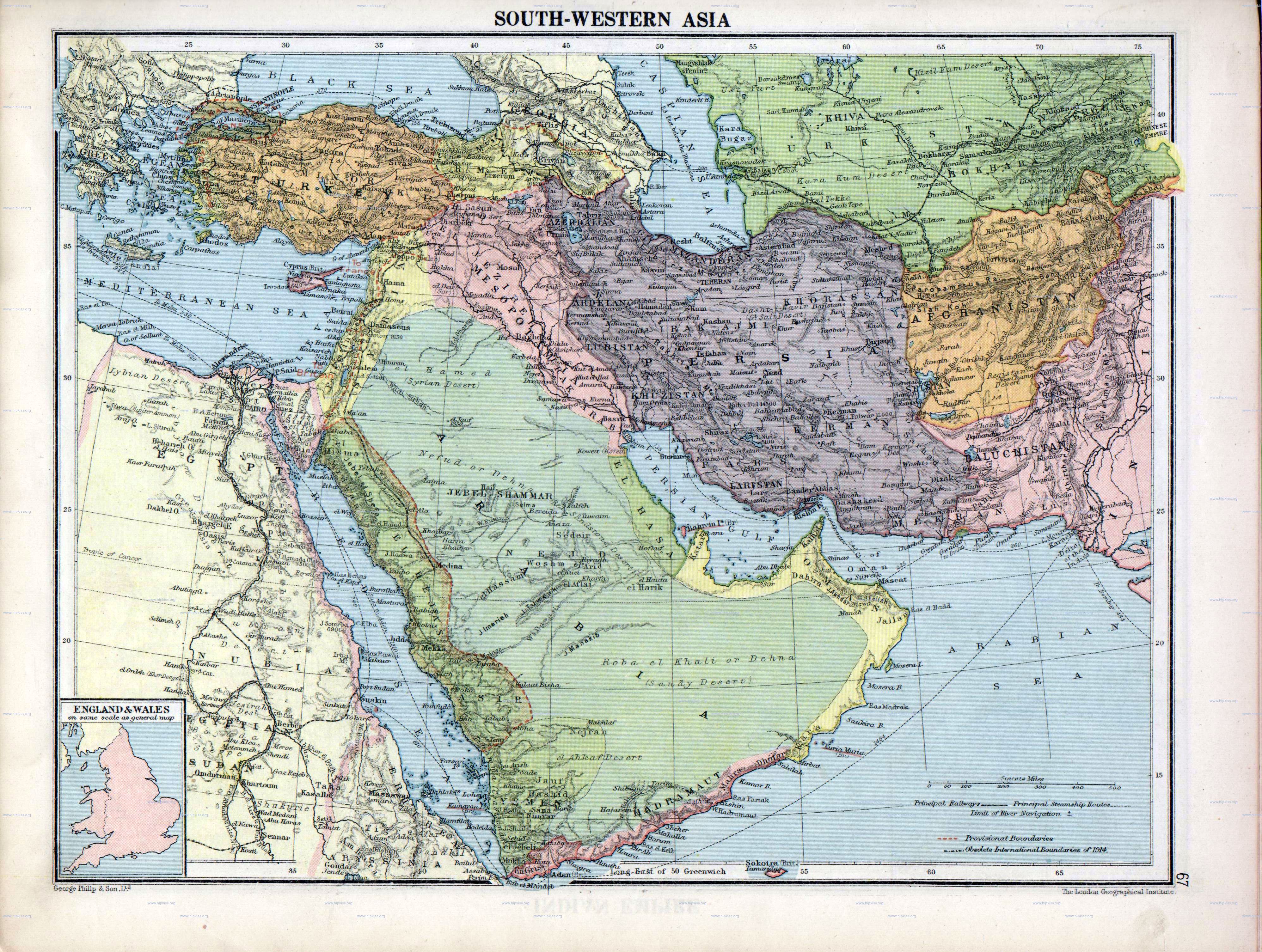
| Description | Asia South Western |
| Date | |
| Source | London Geographical Institute - The Peoples Atlas - 1920 |
| Author | George Philip & Son, Ltd.; scan bei Hipkiss' Scanned Old Maps |
| Other versions |
Derivative works of this file: |
Licensing
|
This work is in the public domain in its country of origin and other countries and areas where the copyright term is the author's life plus 70 years or fewer. | |
| This file has been identified as being free of known restrictions under copyright law, including all related and neighboring rights. | |
This image was taken from my website, without my knowledge, where I beleived its copyright was out of date, however, I am no legal expert and it may be borderline. Before using this image as public domain, check with a lawyer.
File history
Click on a date/time to view the file as it appeared at that time.
| Date/Time | Thumbnail | Dimensions | User | Comment | |
|---|---|---|---|---|---|
| current | 05:07, 1 October 2007 | | 3,992 × 3,012 (2.48 MB) | Busterof666 | {{Information Mideast1920.jpg |Description= Middle East in 1920 |Source= from Jonathan Hipkiss site original map london-geographical-institute_the-peoples-atlas_1920_asia-south-western_3992_3012_600.jpg |Date= |Author= Busterof666 }} |
File usage
The following 4 pages use this file:
Global file usage
The following other wikis use this file:
- Usage on ar.wikipedia.org
- Usage on ca.wikipedia.org
- Usage on es.wikipedia.org
- Usage on eu.wikipedia.org
- Usage on fa.wikipedia.org
- Usage on hy.wikipedia.org
- Usage on it.wikipedia.org
- Usage on pl.wikipedia.org
- Usage on vi.wikipedia.org
- Usage on zh.wikipedia.org