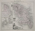
File:Martinique1865.jpg
Appearance

Size of this preview: 674 × 600 pixels. Other resolutions: 270 × 240 pixels | 539 × 480 pixels | 737 × 656 pixels.
Original file (737 × 656 pixels, file size: 135 KB, MIME type: image/jpeg)
File history
Click on a date/time to view the file as it appeared at that time.
| Date/Time | Thumbnail | Dimensions | User | Comment | |
|---|---|---|---|---|---|
| current | 04:07, 10 July 2008 |  | 737 × 656 (135 KB) | Cartol | {{Information |Description=Hand-coloured map of Martinique (right), French Guiana (top left) and Saint Pierre and Miquelon (bottom left). An illustration of Fort-de-France is shown at the lower centre of the map. |Source=[http://www.bergbook.com/htdocs/Ca |
File usage
The following page uses this file:
Global file usage
The following other wikis use this file:
- Usage on hy.wikipedia.org
