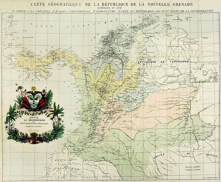
File:Mapa de la Confederación Granadina (1858).jpg
Appearance

Size of this preview: 729 × 599 pixels. Other resolutions: 292 × 240 pixels | 584 × 480 pixels | 934 × 768 pixels | 1,246 × 1,024 pixels | 2,287 × 1,880 pixels.
Original file (2,287 × 1,880 pixels, file size: 1.29 MB, MIME type: image/jpeg)
File history
Click on a date/time to view the file as it appeared at that time.
| Date/Time | Thumbnail | Dimensions | User | Comment | |
|---|---|---|---|---|---|
| current | 16:20, 28 September 2012 |  | 2,287 × 1,880 (1.29 MB) | Milenioscuro | bigger |
| 22:07, 26 September 2011 |  | 683 × 522 (148 KB) | Milenioscuro | {{Information |Description ={{fr|1=Carte Geographique de la Confédération Grenadine (Amérique du Sud) ; pour servir a la création d' écoles industrielle d'agriculture d'arts et métiers dans les huit états de la Confederation.}} |Source = |
File usage
The following 2 pages use this file:
Global file usage
The following other wikis use this file:
- Usage on es.wikipedia.org
- Usage on eu.wikipedia.org
- Usage on fr.wikipedia.org
- Usage on it.wikipedia.org
- Usage on ru.wikipedia.org
- Usage on sv.wikipedia.org
- Usage on www.wikidata.org
