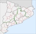
File:Mapa comarcal i municipal de Catalunya.svg
Appearance

Size of this PNG preview of this SVG file: 621 × 600 pixels. Other resolutions: 248 × 240 pixels | 497 × 480 pixels | 795 × 768 pixels | 1,060 × 1,024 pixels | 2,120 × 2,048 pixels | 791 × 764 pixels.
Original file (SVG file, nominally 791 × 764 pixels, file size: 1.16 MB)
File history
Click on a date/time to view the file as it appeared at that time.
| Date/Time | Thumbnail | Dimensions | User | Comment | |
|---|---|---|---|---|---|
| current | 09:14, 5 October 2017 |  | 791 × 764 (1.16 MB) | GeoEvan | Separated file into layers for easier editing, and added vuegeries (regions) as shown in 2017 referendum results factsheet [http://www.catalangovernment.eu/pres_gov/government/en/infographics/303482/catalan-referendum-results.html] |
| 01:36, 22 December 2015 |  | 791 × 764 (1.03 MB) | Rwxrwxrwx | add titles to outlines of municipalities | |
| 13:28, 5 October 2015 |  | 791 × 764 (1.04 MB) | Rwxrwxrwx | fix opacity | |
| 13:10, 5 October 2015 |  | 791 × 764 (1.04 MB) | Rwxrwxrwx | add Medinyà | |
| 00:32, 25 May 2015 |  | 791 × 764 (1.01 MB) | Rwxrwxrwx | mar, fronteres internacionals | |
| 22:40, 9 May 2015 |  | 762 × 739 (1.14 MB) | Rwxrwxrwx | Actualització – afegir Moianès, afegir províncies, millors colors | |
| 13:21, 12 July 2010 |  | 762 × 739 (1.18 MB) | Vinals | {{Information |Description={{ca|1=Mapa comarcal i municipal de Catalunya}} |Source={{own}} |Author=Vilarrubla |Date=12 juliol 2010 |Permission= |other_versions= }} Category:Maps of Catalonia |
File usage
The following page uses this file:
Global file usage
The following other wikis use this file:
- Usage on ar.wikipedia.org
- Usage on el.wikipedia.org
- Usage on he.wikipedia.org
- Usage on hu.wikipedia.org
- Usage on it.wikipedia.org
- Usage on ku.wikipedia.org
- Usage on sco.wikipedia.org
- Usage on sq.wikipedia.org
- Usage on tr.wikipedia.org


