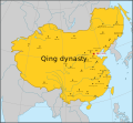
File:Map of Qing dynasty 18c.svg
Appearance

Size of this PNG preview of this SVG file: 649 × 600 pixels. Other resolutions: 260 × 240 pixels | 519 × 480 pixels | 831 × 768 pixels | 1,108 × 1,024 pixels | 2,215 × 2,048 pixels | 834 × 771 pixels.
Original file (SVG file, nominally 834 × 771 pixels, file size: 201 KB)
File history
Click on a date/time to view the file as it appeared at that time.
| Date/Time | Thumbnail | Dimensions | User | Comment | |
|---|---|---|---|---|---|
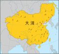
| current | 17:14, 27 May 2022 |  | 834 × 771 (201 KB) | En rouge | The map width has been enlarged to include the full display of Sakhalin. As a result, the Japanese coastlines and the Philippine coastlines were extended. |
| 15:34, 26 December 2020 |  | 512 × 498 (183 KB) | Nv7801 | fix font | |
| 15:33, 26 December 2020 |  | 512 × 498 (180 KB) | Nv7801 | Update | |
| 05:11, 9 August 2016 |  | 790 × 768 (69 KB) | Samhanin | fix | |
| 05:09, 9 August 2016 |  | 790 × 768 (69 KB) | Samhanin | fix | |
| 05:07, 9 August 2016 |  | 790 × 768 (70 KB) | Samhanin | User created page with UploadWizard |
File usage
The following page uses this file:
Global file usage
The following other wikis use this file:
- Usage on io.wikipedia.org
- Usage on it.wikipedia.org
- Usage on ko.wikipedia.org
- Usage on pa.wikipedia.org
- Usage on pnb.wikipedia.org
- Usage on pt.wikipedia.org
- Usage on war.wikipedia.org


