
File:Map of Derbyshire C.1894.jpg
Size of this preview: 486 × 600 pixels. Other resolutions: 194 × 240 pixels | 389 × 480 pixels | 622 × 768 pixels | 830 × 1,024 pixels | 1,398 × 1,725 pixels.
Original file (1,398 × 1,725 pixels, file size: 474 KB, MIME type: image/jpeg)
| This is a file from the Wikimedia Commons. Information from its description page there is shown below. Commons is a freely licensed media file repository. You can help. |
Summary
| Description |
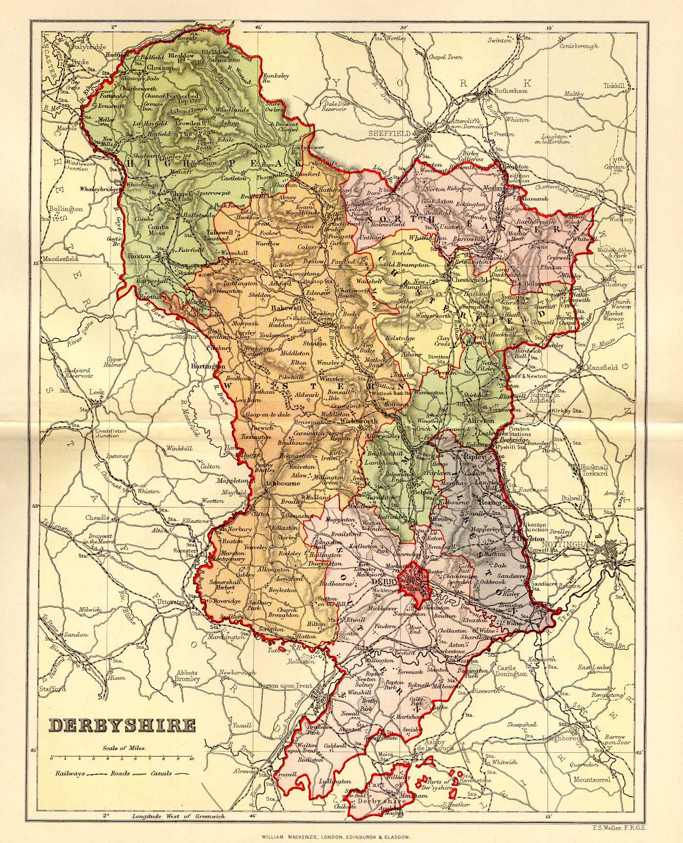
English: Map of the County of Derbyshire C.1894.
The map show's the county's exclaves within both Leicestershire and Staffordshire which were surrendered in 1897. |
| Date | between 1894 and 1895 |
| Source | http://www.uk-genealogy.org.uk/england/Derbyshire/ |
| Author | Unknown author |
Licensing
|
This work is in the public domain in its country of origin and other countries and areas where the copyright term is the author's life plus 70 years or fewer. | |
| This file has been identified as being free of known restrictions under copyright law, including all related and neighboring rights. | |
File history
Click on a date/time to view the file as it appeared at that time.
| Date/Time | Thumbnail | Dimensions | User | Comment | |
|---|---|---|---|---|---|
| current | 10:12, 23 April 2013 | | 1,398 × 1,725 (474 KB) | Rushton2010 | User created page with UploadWizard |
File usage
The following pages on the English Wikipedia use this file (pages on other projects are not listed):