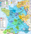
File:Map France 1477-en sovereign Béarn.png
Appearance

Size of this preview: 556 × 599 pixels. Other resolutions: 223 × 240 pixels | 445 × 480 pixels | 900 × 970 pixels.
Original file (900 × 970 pixels, file size: 608 KB, MIME type: image/png)
File history
Click on a date/time to view the file as it appeared at that time.
| Date/Time | Thumbnail | Dimensions | User | Comment | |
|---|---|---|---|---|---|
| current | 18:20, 7 April 2024 |  | 900 × 970 (608 KB) | Jouvencel | First map was correct. Brittany was in the kingdom but not the royal domain. |
| 22:49, 31 January 2019 |  | 900 × 970 (602 KB) | Iñaki LL | Brittany not in the Kingdom of France | |
| 20:27, 9 June 2014 |  | 900 × 970 (608 KB) | Iñaki LLM | User created page with UploadWizard |
File usage
The following 2 pages use this file:
Global file usage
The following other wikis use this file:
- Usage on azb.wikipedia.org
- Usage on el.wikipedia.org
- Usage on eu.wikipedia.org
- Usage on fr.wikipedia.org
- Usage on he.wikipedia.org
- Usage on it.wikipedia.org
- Usage on uk.wikipedia.org
