
File:Map CZ - district Rokycany.PNG

Size of this preview: 800 × 548 pixels. Other resolutions: 320 × 219 pixels | 640 × 439 pixels | 1,024 × 702 pixels | 1,281 × 878 pixels.
Original file (1,281 × 878 pixels, file size: 22 KB, MIME type: image/png)
| This is a file from the Wikimedia Commons. Information from its description page there is shown below. Commons is a freely licensed media file repository. You can help. |
Summary
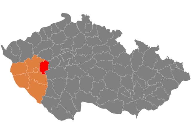
| Description | Location of Rokycany District in Plzeň Region and the Czech Republic. |
| Source | self-made, based on Image:Czech_Republic_districts.png |
| Author | Hanhil |
Licensing
| I, the copyright holder of this work, release this work into the public domain. This applies worldwide. In some countries this may not be legally possible; if so: I grant anyone the right to use this work for any purpose, without any conditions, unless such conditions are required by law. |
File history
Click on a date/time to view the file as it appeared at that time.
| Date/Time | Thumbnail | Dimensions | User | Comment | |
|---|---|---|---|---|---|
| current | 19:45, 11 February 2008 | | 1,281 × 878 (22 KB) | Hanhil | {{Information |Description=Locator_maps_of_districts_of_the_Czech_Republic. |Source=self-made, based on Image:Czech_Republic_districts.png |Date= |Author= Hanhil }} == Licensing == {{PD-self}} [[category:Locator_maps_of_districts_of |
File usage
The following page uses this file:
Global file usage
The following other wikis use this file:
- Usage on ar.wikipedia.org
- Usage on azb.wikipedia.org
- Usage on bg.wikipedia.org
- Usage on de.wikipedia.org
- Usage on fa.wikipedia.org
- Usage on frr.wikipedia.org
- Usage on fr.wikipedia.org
- Usage on hu.wikipedia.org
- Usage on it.wikipedia.org
- Usage on ka.wikipedia.org
- Usage on ms.wikipedia.org
- Usage on nl.wikipedia.org
- Usage on pl.wikipedia.org
- Usage on pnb.wikipedia.org
- Usage on pt.wikipedia.org
- Rokycany (distrito)
- Rokycany
- Predefinição:Distrito de Rokycany
- Zvíkovec
- Bezděkov (Rokycany)
- Břasy
- Březina (Plzeň)
- Bujesily
- Bušovice
- Cekov
- Cheznovice
- Chlum (Rokycany)
- Chomle
- Čilá
- Dobřív
- Drahoňův Újezd
- Ejpovice
- Hlohovice
- Holoubkov
- Hradiště (Rokycany)
- Hůrky
- Kakejcov
- Kamenec
- Kamenný Újezd (Plzeň)
- Kařez
- Kařízek
- Klabava
- Kladruby (Rokycany)
- Kornatice
- Lhota pod Radčem
- Lhotka u Radnic
- Liblín
- Líšná (Plzeň)
- Litohlavy
- Medový Újezd
- Mešno
View more global usage of this file.