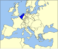
File:Map-Europe 1815-Netherlands.svg
Appearance

Size of this PNG preview of this SVG file: 710 × 600 pixels. Other resolutions: 284 × 240 pixels | 569 × 480 pixels | 910 × 768 pixels | 1,213 × 1,024 pixels | 2,426 × 2,048 pixels | 9,086 × 7,672 pixels.
Original file (SVG file, nominally 9,086 × 7,672 pixels, file size: 1.73 MB)
File history
Click on a date/time to view the file as it appeared at that time.
| Date/Time | Thumbnail | Dimensions | User | Comment | |
|---|---|---|---|---|---|
| current | 13:46, 7 September 2007 |  | 9,086 × 7,672 (1.73 MB) | Sir Iain | {{Information |Description=Map of the United Kingdom of The Netherlands (1815-1830) in Europe |Source=Based on Image:Map-GermanConfederation.svg by User:52_Pickup |Date=5 sept 2007 |Author=User:Sir_Iain, User:52_Pickup |Permission= |other_ |
File usage
The following page uses this file:
Global file usage
The following other wikis use this file:
- Usage on be.wikipedia.org
- Usage on br.wikipedia.org
- Usage on he.wikipedia.org
- Usage on lt.wikipedia.org
- Usage on mr.wikipedia.org
- Usage on nl.wikipedia.org
- Usage on pl.wikipedia.org
- Usage on pt.wikipedia.org
- Usage on ro.wikipedia.org
- Usage on simple.wikipedia.org
- Usage on sv.wikipedia.org
- Usage on tr.wikipedia.org
- Usage on yo.wikipedia.org
- Usage on zh.wikipedia.org

