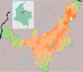
File:Locator Map of Boyacá Colombia.svg
Appearance

Size of this PNG preview of this SVG file: 693 × 600 pixels. Other resolutions: 277 × 240 pixels | 555 × 480 pixels | 888 × 768 pixels | 1,183 × 1,024 pixels | 2,367 × 2,048 pixels | 2,452 × 2,122 pixels.
Original file (SVG file, nominally 2,452 × 2,122 pixels, file size: 484 KB)
File history
Click on a date/time to view the file as it appeared at that time.
| Date/Time | Thumbnail | Dimensions | User | Comment | |
|---|---|---|---|---|---|
| current | 09:36, 12 August 2010 |  | 2,452 × 2,122 (484 KB) | Petruss | Ajustes |
| 08:01, 12 August 2010 |  | 2,635 × 3,602 (348 KB) | Petruss | Margenes diferentes | |
| 07:28, 12 August 2010 |  | 2,635 × 2,153 (348 KB) | Petruss | Error en carga | |
| 07:25, 12 August 2010 |  | 236 × 461 (348 KB) | Petruss | Mas ajustes a los bordes | |
| 07:21, 12 August 2010 |  | 2,784 × 2,239 (349 KB) | Petruss | Arreglo bordes | |
| 05:55, 12 August 2010 |  | 2,873 × 2,487 (351 KB) | Petruss | {{Information |Description={{es|1=Mapa físico del departamento de Boyacá en Colombia}} |Source={{own}} |Author=Petruss |Date=11 de agosto de 2010 |Permission= |other_versions= }} Uso para localizador en el departamento |
File usage
The following 4 pages use this file:
Global file usage
The following other wikis use this file:
- Usage on es.wikipedia.org
- Usage on fa.wikipedia.org
- Usage on si.wikipedia.org
- Usage on uz.wikipedia.org
