
File:L'Eyrieux du pont de Saint Sauveur de Montagut 2007 05 19.jpg

Size of this preview: 450 × 600 pixels. Other resolutions: 180 × 240 pixels | 360 × 480 pixels | 576 × 768 pixels | 768 × 1,024 pixels | 1,536 × 2,048 pixels.
Original file (1,536 × 2,048 pixels, file size: 4.69 MB, MIME type: image/jpeg)
| This is a file from the Wikimedia Commons. Information from its description page there is shown below. Commons is a freely licensed media file repository. You can help. |
Summary
| Description |
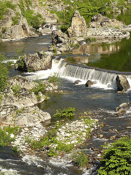
Français : Vue en amont de l'Eyrieux depuis le pont de Saint Sauveur de Montagut(20 km environ du confluent du Rhône), sur un lit granitique, débit moyen après des pluies de printemps. Deux "levées" construites, visibles, permettaient l'utilisation de la force hydraulique par des canaux latéraux conduisant l'eau à des turbines d'usines |
| Date | [07 05 19] |
| Source | Own work |
| Author | CahliS |
Licensing
I, the copyright holder of this work, hereby publish it under the following licenses:

|
Permission is granted to copy, distribute and/or modify this document under the terms of the GNU Free Documentation License, Version 1.2 or any later version published by the Free Software Foundation; with no Invariant Sections, no Front-Cover Texts, and no Back-Cover Texts. A copy of the license is included in the section entitled GNU Free Documentation License. |
This file is licensed under the Creative Commons Attribution-Share Alike 3.0 Unported, 2.5 Generic, 2.0 Generic and 1.0 Generic license.
- You are free:
- to share – to copy, distribute and transmit the work
- to remix – to adapt the work
- Under the following conditions:
- attribution – You must give appropriate credit, provide a link to the license, and indicate if changes were made. You may do so in any reasonable manner, but not in any way that suggests the licensor endorses you or your use.
- share alike – If you remix, transform, or build upon the material, you must distribute your contributions under the same or compatible license as the original.
You may select the license of your choice.
File history
Click on a date/time to view the file as it appeared at that time.
| Date/Time | Thumbnail | Dimensions | User | Comment | |
|---|---|---|---|---|---|
| current | 15:35, 20 October 2007 | | 1,536 × 2,048 (4.69 MB) | CahliS | {{Information=Image:JPEG 4,69Mo 1536x2048 |Description=[Vue en amont de l'Eyrieux depuis le pont de Saint Sauveur de Montagut(20 km environ du confluent du Rhône), sur un lit granitique, débit moyen après des pluies de printemps. Deux "levées" c |
File usage
The following pages on the English Wikipedia use this file (pages on other projects are not listed):
Global file usage
The following other wikis use this file:
- Usage on ceb.wikipedia.org
- Usage on da.wikipedia.org
- Usage on de.wikipedia.org
- Usage on es.wikipedia.org
- Usage on fr.wikipedia.org
- Usage on ja.wikipedia.org
- Usage on pl.wikipedia.org
- Usage on simple.wikipedia.org
- Usage on sr.wikipedia.org
- Usage on www.wikidata.org
- Usage on zh.wikipedia.org