
File:Kurinskoe khanstvo in the Map of Caucasus with the borders 1801-1813.png

No higher resolution available.
Kurinskoe_khanstvo_in_the_Map_of_Caucasus_with_the_borders_1801-1813.png (708 × 465 pixels, file size: 707 KB, MIME type: image/png)
| This is a file from the Wikimedia Commons. Information from its description page there is shown below. Commons is a freely licensed media file repository. You can help. |
| Description |
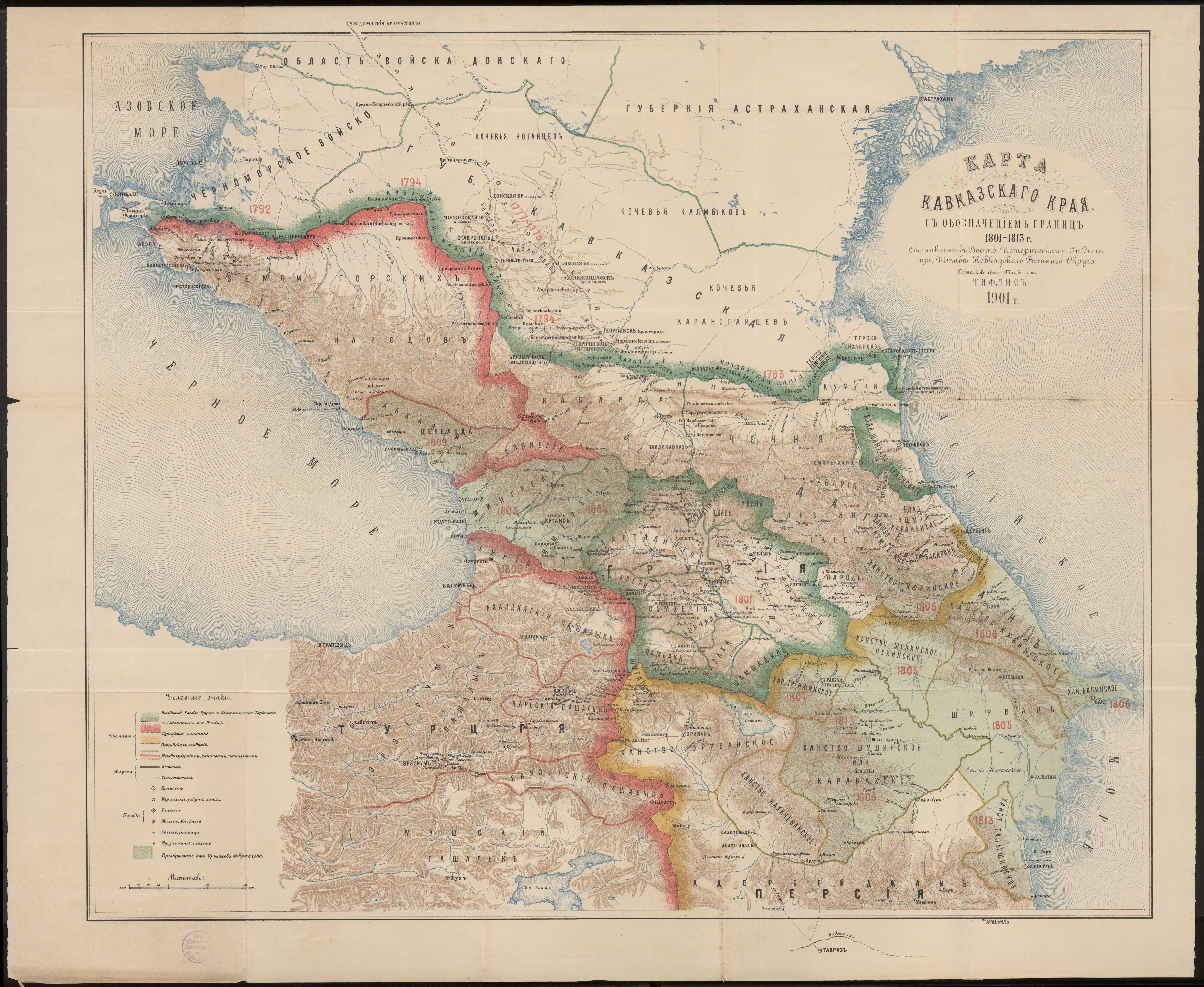
English: Kurinskoe khanstvo in the Map of Caucasus with the borders 1801-1813 |
| Date | |
| Source | Карта Кавказского края с обозначением границ 1801-1813 г. Составлена в военно-историческом отделе при штабе Кавказского военного округа подполковником Томкиевым. Тифлис 1901 г. |
| Author | Томкиев |
|
This work is in the public domain in its country of origin and other countries and areas where the copyright term is the author's life plus 70 years or fewer. | |
| This file has been identified as being free of known restrictions under copyright law, including all related and neighboring rights. | |
File history
Click on a date/time to view the file as it appeared at that time.
| Date/Time | Thumbnail | Dimensions | User | Comment | |
|---|---|---|---|---|---|
| current | 19:41, 10 October 2012 | | 708 × 465 (707 KB) | Interfase | {{Information |Description ={{en|1=Kurinskoe khanstvo in the Map of Caucasus with the borders 1801-1813}} |Source =[http://xn--b1aaibpv0aet4h1a.xn--p1ai/forums/uploads/gallery/album_19/gallery_4_19_4287845.jpg Карта Кавказско... |
File usage
The following page uses this file:
Global file usage
The following other wikis use this file:
- Usage on az.wikipedia.org
- Usage on ru.wikipedia.org
- Usage on uk.wikipedia.org
- Usage on www.wikidata.org