
File:Kent city wards2 streets.jpg
Original file (900 × 675 pixels, file size: 935 KB, MIME type: image/jpeg)
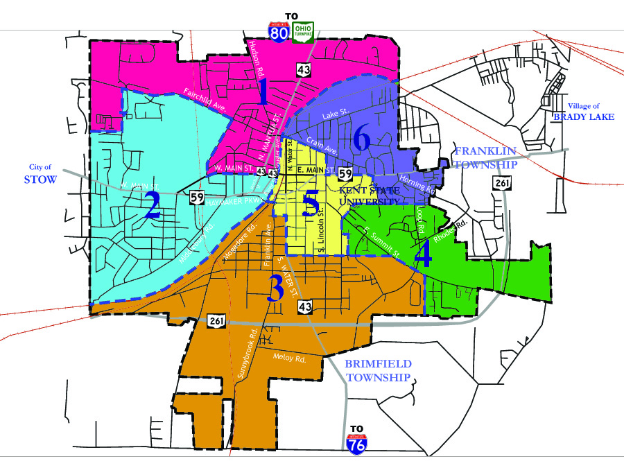
Map showing ward boundaries for the city of Kent, Ohio. Original map from www.kentohio.org (City of Kent website), colors and streets added by Jon Ridinger, 2006.
| This work has been released into the public domain by the copyright holder. This applies worldwide. In case this is not legally possible: |
 | This file is a candidate to be copied to Wikimedia Commons.
Any user may perform this transfer; refer to Wikipedia:Moving files to Commons for details. If this file has problems with attribution, copyright, or is otherwise ineligible for Commons, then remove this tag and DO NOT transfer it; repeat violators may be blocked from editing. Other Instructions
| ||
| |||
| This media file is either in the public domain or published under a free license, and contains no inbound file links. If this media file is useful, then it should be transferred to the Wikimedia Commons. If this media is not useful, then please propose it for deletion or list it at files for discussion. |
File history
Click on a date/time to view the file as it appeared at that time.
| Date/Time | Thumbnail | Dimensions | User | Comment | |
|---|---|---|---|---|---|
| current | 06:12, 24 October 2006 | | 900 × 675 (935 KB) | JonRidinger (talk | contribs) | Map showing ward boundaries for the city of Kent, Ohio. Original map from www.kentohio.org (City of Kent website), colors and streets added by Jon Ridinger, 2006. {{CopyrightedFreeUse}} |
| 06:07, 24 October 2006 |  | 900 × 675 (935 KB) | JonRidinger (talk | contribs) | Map showing ward boundaries for the city of Kent, Ohio. Original map from www.kentohio.org (City of Kent website), colors and streets added by Jon Ridinger, 2006. {{CopyrightedFreeUse}} |
You cannot overwrite this file.