
File:Karte Lohmühleninsel Berlin.JPG
Size of this preview: 800 × 518 pixels. Other resolutions: 320 × 207 pixels | 640 × 415 pixels | 929 × 602 pixels.
Original file (929 × 602 pixels, file size: 169 KB, MIME type: image/jpeg)
| This is a file from the Wikimedia Commons. Information from its description page there is shown below. Commons is a freely licensed media file repository. You can help. |
Summary
|
|
Licensing
|
This work is in the public domain in its country of origin and other countries and areas where the copyright term is the author's life plus 70 years or fewer. | |
| This file has been identified as being free of known restrictions under copyright law, including all related and neighboring rights. | |
File history
Click on a date/time to view the file as it appeared at that time.
| Date/Time | Thumbnail | Dimensions | User | Comment | |
|---|---|---|---|---|---|
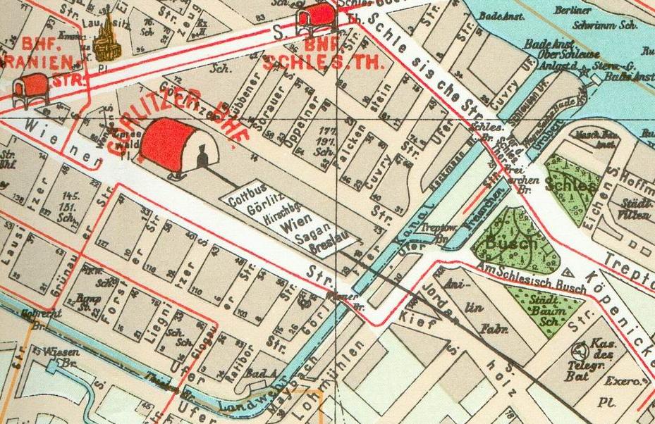
| current | 20:06, 6 March 2006 | | 929 × 602 (169 KB) | Lienhard Schulz | {| width="100%" | width="50%" valign="top" background="#ffffff" | 20px|Deutsch '''de:''' *'''Beschreibung''': Ausschnitt aus dem Pharus-Plan Berlin von 1902 um den Bereich der Lohmühleninsel in Berlin-Kreuzberg. Auf der Gru |
File usage
The following pages on the English Wikipedia use this file (pages on other projects are not listed):
Global file usage
The following other wikis use this file:
- Usage on de.wikipedia.org
- Usage on ja.wikipedia.org
- Usage on nl.wikipedia.org