
File:Istanbul PU889.jpg

Original file (7,284 × 5,043 pixels, file size: 6.23 MB, MIME type: image/jpeg)
| This is a file from the Wikimedia Commons. Information from its description page there is shown below. Commons is a freely licensed media file repository. You can help. |
Summary
|
| Description |
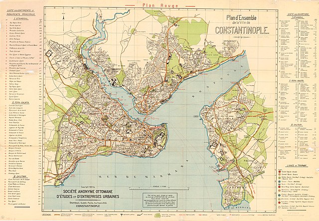
Istanbul city map Title: Plan d'ensemble de la ville de Constantinople. Publisher: Societe anonyme ottomane d'etudes et d'enterprises urbaines PubInfo: 1922 Description: This map was scanned with a Chroma Tx 40 Plus Wide Format color scanner and WIDEimage 2.8 software at 400 DPI in 24-bit color. The image was then reduced to 256 colors and saved in a TIFF file format. Later the TIFF image was compressed by the Mapping Sci |
| Date | |
| Source | Princeton Library http://gisserver.princeton.edu:81/navigatorMapViewer.htm?map=889 |
| Author | Societe anonyme ottomane d'etudes et d'enterprises urbaines |
Licensing
|
This work is in the public domain in its country of origin and other countries and areas where the copyright term is the author's life plus 70 years or fewer. | |
| This file has been identified as being free of known restrictions under copyright law, including all related and neighboring rights. | |
Summary (original)
Plan d'Istanbul par la Société Anonyme Ottomane d'Etudes et d'Enterprises Urbaines, 1922
File history
Click on a date/time to view the file as it appeared at that time.
| Date/Time | Thumbnail | Dimensions | User | Comment | |
|---|---|---|---|---|---|
| current | 12:31, 26 January 2013 | | 7,284 × 5,043 (6.23 MB) | Slick-o-bot | Bot: convert to a non-interlaced jpeg (see bug #17645) |
| 11:59, 10 December 2005 |  | 7,284 × 5,043 (5.88 MB) | Neuceu | Plan d'Istanbul par la Société Anonyme Ottomane d'Etudes et d'Enterprises Urbaines, 1922 Source : http://gisserver.princeton.edu/metadataexplorer/search_results.jsp?goTo=search&north=41.718465&south=40.625131&east=29.386666&west=28&mode=ME&loggedIn=fal |
File usage
Global file usage
The following other wikis use this file:
- Usage on af.wikipedia.org
- Usage on ckb.wikipedia.org
- Usage on fr.wikipedia.org
- Usage on fy.wikipedia.org
- Usage on he.wikipedia.org
- Usage on mk.wikipedia.org
- Usage on pcd.wikipedia.org
- Usage on tk.wikipedia.org
- Usage on tr.wikipedia.org
- İstanbul'un ilçeleri
- İstanbul tarihi
- Vikipedi:Seçkin resimler
- Vikipedi:Günün seçkin resmi/Aralık 2011
- Vikipedi:Seçkin resim adayları/Istanbul PU889.jpg
- Vikipedi:Seçkin resim adayları/Arşiv/Nisan 2010
- Vikipedi:Seçkin resimler/Çizimler, diyagramlar ve haritalar/Haritalar
- Kullanıcı mesaj:Seksen iki yüz kırk beş/Arşiv 1
- Vikipedi:Seçkin resimler/Ana sayfaya çıkmış resimler/2011 listesi
- Şablon:GSR/2011-12-29
- İstanbul (il)
- Vikipedi:Günün seçkin resmi/Mayıs 2019
- Şablon:GSR/2019-05-14
- Şablon:GSR/2024-02-08
- Vikipedi:Günün seçkin resmi/Şubat 2024