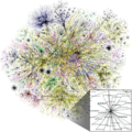
File:Internet map 1024 - transparent, inverted.png
Appearance

Size of this preview: 600 × 600 pixels. Other resolutions: 240 × 240 pixels | 480 × 480 pixels | 768 × 768 pixels | 1,024 × 1,024 pixels | 1,280 × 1,280 pixels.
Original file (1,280 × 1,280 pixels, file size: 2.23 MB, MIME type: image/png)
File history
Click on a date/time to view the file as it appeared at that time.
| Date/Time | Thumbnail | Dimensions | User | Comment | |
|---|---|---|---|---|---|
| current | 12:23, 27 August 2016 |  | 1,280 × 1,280 (2.23 MB) | Kesäperuna | Optimized with OptiPNG |
| 21:30, 7 February 2015 |  | 1,280 × 1,280 (2.56 MB) | Rezonansowy | Reverted to version as of 15:43, 22 April 2013; eeh it;'s not so better | |
| 20:19, 28 April 2013 |  | 1,280 × 1,280 (1.51 MB) | Rezonansowy | better quality & original colors | |
| 15:43, 22 April 2013 |  | 1,280 × 1,280 (2.56 MB) | Rezonansowy | transparent | |
| 17:52, 21 April 2013 |  | 1,280 × 1,280 (2.58 MB) | Rezonansowy | User created page with UploadWizard |
File usage
More than 100 pages use this file. The following list shows the first 100 pages that use this file only. A full list is available.
- Anonymous (hacker group)
- Blog
- Bomb-making instructions on the Internet
- Censorship in the United States
- Computer and network surveillance
- Cyberbullying
- Digital privacy
- Digital rights
- Domain name speculation
- Doxing
- E-democracy
- Emoji
- Emoticon
- Eternal September
- Etymologiae
- Flaming (Internet)
- Geography
- Griefer
- History of the Internet
- ICANN
- Imageboard
- Information infrastructure
- Intergalactic Computer Network
- Internet
- Internet Assigned Numbers Authority
- Internet Engineering Task Force
- Internet Governance Forum
- Internet Society
- Internet Society – Bulgaria
- Internet access
- Internet censorship
- Internet censorship in Germany
- Internet censorship in Hong Kong
- Internet censorship in India
- Internet censorship in Pakistan
- Internet censorship in South Korea
- Internet culture
- Internet governance
- Internet in China
- Internet in Iceland
- Internet in India
- Internet in Moldova
- Internet in North Korea
- Internet in Poland
- Internet in Thailand
- Internet in Ukraine
- Internet in the Czech Republic
- Internet in the Philippines
- Internet in the Republic of Ireland
- Internet in the United Kingdom
- Internet in the United States
- Internet linguistics
- Internet meme
- Internet police
- Internet slang
- Interplanetary Internet
- LOL
- Leet
- List of Internet phenomena
- List of Internet pioneers
- List of sovereign states by number of Internet hosts
- List of sovereign states by number of broadband Internet subscriptions
- List of the oldest currently registered Internet domain names
- Lolcat
- Lurker
- Make Money Fast
- Mass media in China
- Micro Transport Protocol
- Net neutrality
- Newbie
- Not safe for work
- O RLY?
- Online shopping
- Owned (slang)
- Packet switching
- Padonkaffsky jargon
- Pedobear
- Propaganda in China
- Regional Internet registry
- Registered user
- Rickrolling
- Right to Internet access
- Rule 34
- SMS language
- Security hacker
- Sexting
- Shadow banning
- Sociology of the Internet
- TL;DR
- Tankie
- Teh
- Timeline of Internet conflicts
- Troll (slang)
- Usenet
- W00t
- Who Controls the Internet?
- World Day Against Cyber Censorship
- User:BarnabyJoe
- User:Smartse
- Wikipedia:Top 25 Report/June 23 to 29, 2013
View more links to this file.
Global file usage
The following other wikis use this file:
- Usage on ang.wikipedia.org
- Usage on ar.wikipedia.org
- إنترنت
- برمجية خبيثة
- فجوة إلكترونية
- إباحية
- منتدى إنترنت
- برمجية تجسس
- آيكان
- انفعالة (ثقافة إنترنت)
- نيوبي
- لول
- اتصال بالإنترنت
- رسالة مزعجة (حوسبة)
- فورتشان
- أنونيموس (مجموعة)
- ميم إنترنت
- متصيد (إنترنت)
- عامية الإنترنت
- لييت
- تاريخ الإنترنت
- مجتمع افتراضي
- بيدوبير
- مراسلة جنسية
- تنمر على الإنترنت
- قالب:إنترنت
- قالب:عامية الإنترنت
- غير مناسب للعمل
- نقطة تبادل إنترنت
- استقاء معلومات شخصية
- لوحة صور
- تحرير مقالة
- لولكات
- مخترق أمني
- مضايقة (إنترنت)
- مستخدم:تامر دهامشة/ملعب
- لسانيات الإنترنت
- القاعدة 34 (ميم إنترنت)
- حقوق رقمية فلسطينية
- مستخدم:تقنيه المعلومات بغداد/ملعب
- مستخدم الكومبيوتر الغبي
- حوكمة الإنترنت
- الرقابة على الإنترنت في الهند
- الرقابة على الإنترنت في باكستان
- جماعة تشاور (إنترنت)
- الرقابة على الإنترنت في هونغ كونغ
- التعاطف في المجتمعات عبر الإنترنت
- قائمة الدول ذات السيادة حسب عدد مضيفي الإنترنت
- Usage on ar.wikiversity.org
- Usage on ary.wikipedia.org
View more global usage of this file.

