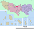
File:基礎自治体位置図 13220.svg
Appearance

Size of this PNG preview of this SVG file: 786 × 599 pixels. Other resolutions: 315 × 240 pixels | 630 × 480 pixels | 1,007 × 768 pixels | 1,280 × 976 pixels | 2,560 × 1,952 pixels | 6,000 × 4,575 pixels.
Original file (SVG file, nominally 6,000 × 4,575 pixels, file size: 2.72 MB)
File history
Click on a date/time to view the file as it appeared at that time.
| Date/Time | Thumbnail | Dimensions | User | Comment | |
|---|---|---|---|---|---|
| current | 04:00, 27 December 2023 |  | 6,000 × 4,575 (2.72 MB) | Sanmosa | Reverted to version as of 03:45, 27 December 2023 (UTC) |
| 03:53, 27 December 2023 |  | 6,000 × 4,575 (317 KB) | Sanmosa | Reverted to version as of 03:32, 27 December 2023 (UTC) | |
| 03:49, 27 December 2023 |  | 6,000 × 4,575 (2.72 MB) | Sanmosa | 3rd update | |
| 03:45, 27 December 2023 |  | 6,000 × 4,575 (2.72 MB) | Sanmosa | Better update | |
| 03:32, 27 December 2023 |  | 6,000 × 4,575 (317 KB) | Sanmosa | Update style | |
| 14:15, 12 September 2007 |  | 800 × 682 (23 KB) | Lincun | {{基礎自治体位置図画像情報|東京都|東大和市}} |
File usage
The following page uses this file:
Global file usage
The following other wikis use this file:
- Usage on ar.wikipedia.org
- Usage on ca.wikipedia.org
- Usage on ce.wikipedia.org
- Usage on et.wikipedia.org
- Usage on eu.wikipedia.org
- Usage on fi.wikipedia.org
- Usage on fr.wikipedia.org
- Usage on gl.wikipedia.org
- Usage on id.wikipedia.org
- Usage on ja.wikipedia.org
- Usage on jv.wikipedia.org
- Usage on ko.wikipedia.org
- Usage on mzn.wikipedia.org
- Usage on pl.wikipedia.org
- Usage on ro.wikipedia.org
- Usage on sv.wikipedia.org
- Usage on tt.wikipedia.org
- Usage on vi.wikipedia.org
- Usage on www.wikidata.org

