
File:Glenview Creek Hand-Drawn Map v2.jpg
Size of this preview: 687 × 599 pixels. Other resolutions: 275 × 240 pixels | 550 × 480 pixels | 880 × 768 pixels | 1,174 × 1,024 pixels | 1,504 × 1,312 pixels.
Original file (1,504 × 1,312 pixels, file size: 164 KB, MIME type: image/jpeg)
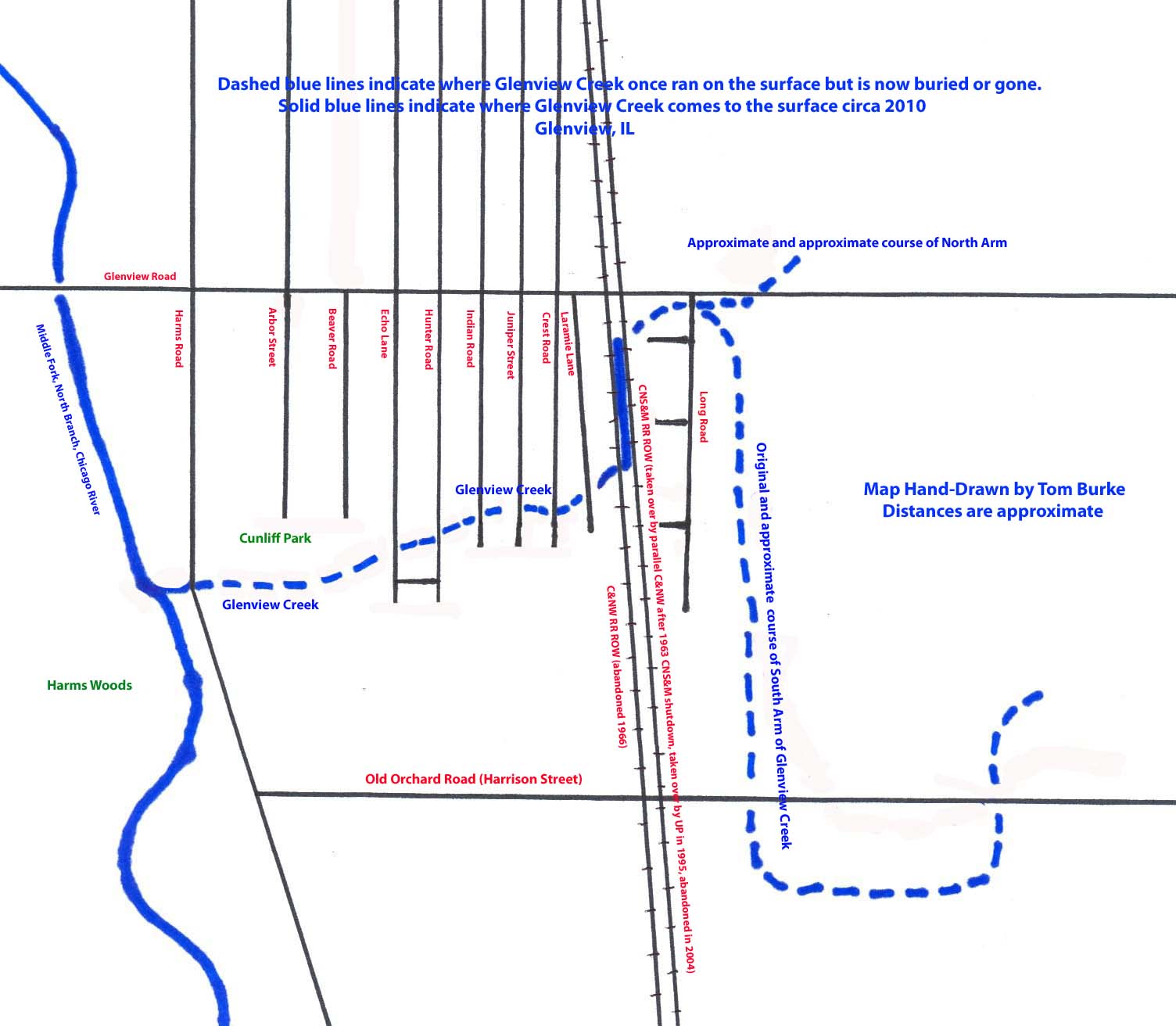
Hand-drawn map of Glenview Creek showing its approximate location on the southeast side of Glenview, IL. Map created in 2011.
 | I, the copyright holder of this work, hereby grant the permission to copy, distribute and/or modify this document under the terms of the GNU Free Documentation License, Version 1.2 or any later version published by the Free Software Foundation; with no Invariant Sections, no Front-Cover Texts, and no Back-Cover Texts. |
 | This file is a candidate to be copied to Wikimedia Commons.
Any user may perform this transfer; refer to Wikipedia:Moving files to Commons for details. If this file has problems with attribution, copyright, or is otherwise ineligible for Commons, then remove this tag and DO NOT transfer it; repeat violators may be blocked from editing. Other Instructions
| ||
| |||
| This media file is either in the public domain or published under a free license, and contains no inbound file links. If this media file is useful, then it should be transferred to the Wikimedia Commons. If this media is not useful, then please propose it for deletion or list it at files for discussion. |
File history
Click on a date/time to view the file as it appeared at that time.
| Date/Time | Thumbnail | Dimensions | User | Comment | |
|---|---|---|---|---|---|
| current | 20:30, 3 February 2011 | | 1,504 × 1,312 (164 KB) | Burke, Tom (talk | contribs) | Hand-drawn map of Glenview Creek showing its approximate location on the southeast side of Glenview, IL. Map created in 2011. {{GFDL-self}} |
You cannot overwrite this file.
File usage
No pages on the English Wikipedia use this file (pages on other projects are not listed).