
File:Europe around 800.gif
Size of this preview: 765 × 599 pixels. Other resolutions: 306 × 240 pixels | 613 × 480 pixels | 980 × 768 pixels | 1,280 × 1,003 pixels | 1,737 × 1,361 pixels.
Original file (1,737 × 1,361 pixels, file size: 1.07 MB, MIME type: image/gif)
| This is a file from the Wikimedia Commons. Information from its description page there is shown below. Commons is a freely licensed media file repository. You can help. |
Summary
| Description |
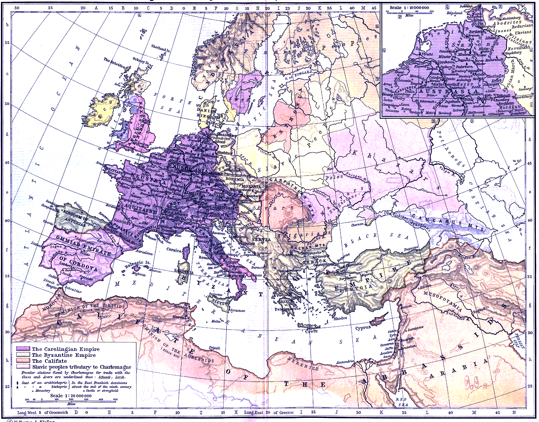
English: Europe around 800 (public domain map) |
| Date | |
| Source | http://rbedrosian.com/Maps/ (According to the page this map is public domain from from the Historical Atlas (New York, 1911) |
| Author | by William R. Shepherd (1871-1934) |
Licensing
|
This work is in the public domain in its country of origin and other countries and areas where the copyright term is the author's life plus 70 years or fewer. | |
| This file has been identified as being free of known restrictions under copyright law, including all related and neighboring rights. | |
File history
Click on a date/time to view the file as it appeared at that time.
| Date/Time | Thumbnail | Dimensions | User | Comment | |
|---|---|---|---|---|---|
| current | 21:13, 29 November 2022 | | 1,737 × 1,361 (1.07 MB) | Gyalu22 | less blue more white |
| 23:13, 30 March 2014 |  | 1,737 × 1,361 (1.33 MB) | Fakirbakir | better colors | |
| 17:47, 17 October 2011 |  | 1,737 × 1,361 (1.34 MB) | Fakirbakir |
File usage
The following pages on the English Wikipedia use this file (pages on other projects are not listed):
Global file usage
The following other wikis use this file:
- Usage on ast.wikipedia.org
- Usage on el.wikipedia.org
- Usage on es.wikipedia.org
- Usage on et.wikipedia.org
- Usage on he.wikipedia.org
- Usage on hu.wikipedia.org
- Usage on ja.wikipedia.org
- Usage on mk.wikipedia.org
- Usage on ro.wikipedia.org
- Usage on sl.wikipedia.org