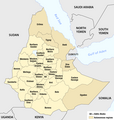
File:Ethiopia - Administrative regions 1987-1991.png
Appearance

Size of this preview: 570 × 600 pixels. Other resolutions: 228 × 240 pixels | 456 × 480 pixels | 730 × 768 pixels | 1,266 × 1,332 pixels.
Original file (1,266 × 1,332 pixels, file size: 203 KB, MIME type: image/png)
File history
Click on a date/time to view the file as it appeared at that time.
| Date/Time | Thumbnail | Dimensions | User | Comment | |
|---|---|---|---|---|---|
| current | 07:02, 23 October 2016 |  | 1,266 × 1,332 (203 KB) | Chumwa | == {{int:filedesc}} == {{Information |Description = {{de|1=Karte der Verwaltungsgliederung Äthiopiens 1987-1991}} {{en|1=Map of the 30 regions of Ethiopia, 1987-1991}} |Source = {{own}}, using the information from * Negussay Ayele: ''[http:/... |
File usage
The following page uses this file:
Global file usage
The following other wikis use this file:
- Usage on el.wikipedia.org
- Usage on es.wikipedia.org
- Usage on ja.wikipedia.org
- Usage on pl.wikipedia.org


