
File:Eredvi in 2010.jpg
Size of this preview: 800 × 533 pixels. Other resolutions: 320 × 213 pixels | 640 × 427 pixels | 1,024 × 683 pixels | 1,200 × 800 pixels.
Original file (1,200 × 800 pixels, file size: 837 KB, MIME type: image/jpeg)
| This is a file from the Wikimedia Commons. Information from its description page there is shown below. Commons is a freely licensed media file repository. You can help. |
Summary
| Description |
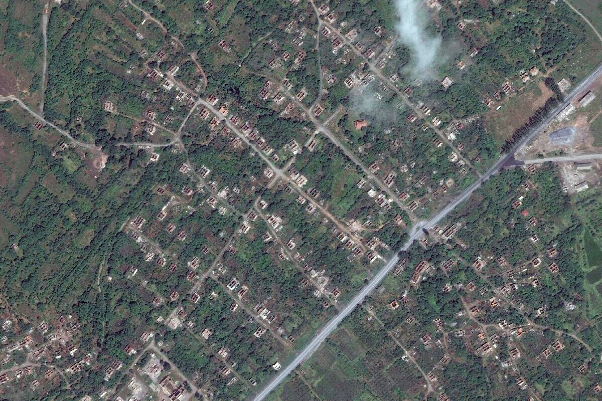
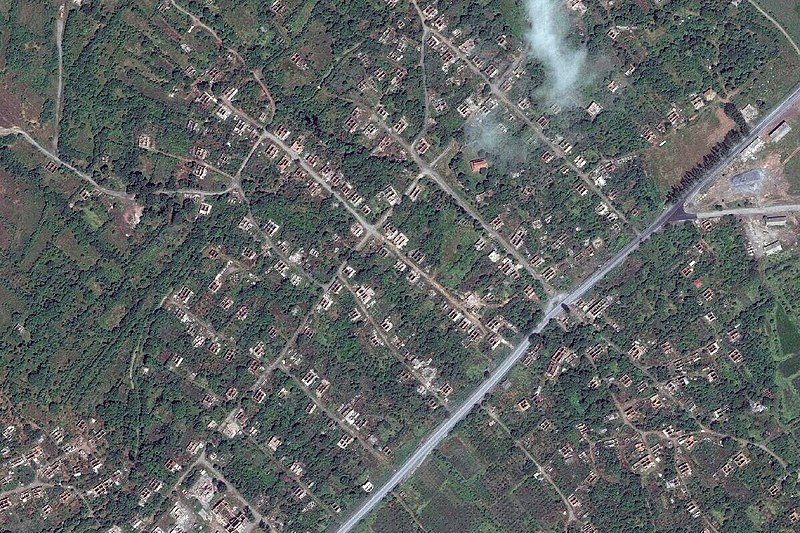
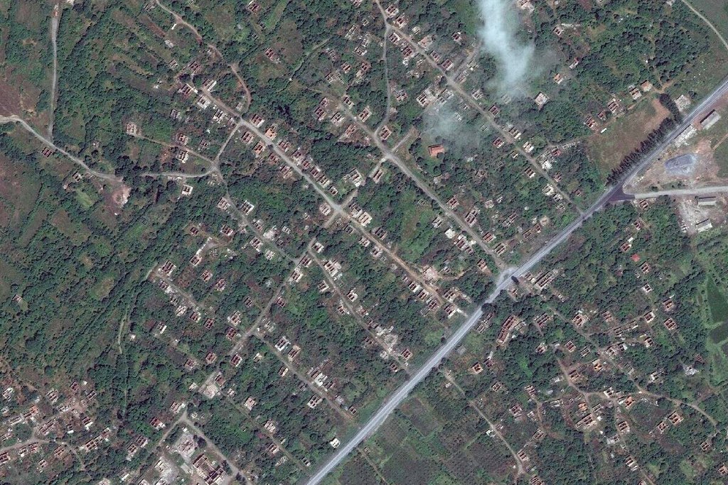
English: The village Eredvi, 6 kilometers east of Tskhinvali was depopulated, burnt down and demolished as result of the 2008 Russo-Georgian war. The photo depicts the 2010 situation. Between 2017 and 2020 all remains of Kurta have been removed. The village still exists pro-forma as Irykau in Ossetian, but no one lives here. |
| Date | |
| Source | NASA, Landsat, via ESRI Landsat Viewer. |
| Author | NASA |
Licensing
| This file is in the public domain in the United States because it was solely created by NASA. NASA copyright policy states that "NASA material is not protected by copyright unless noted". (See Template:PD-USGov, NASA copyright policy page or JPL Image Use Policy.) | ||
 |
Warnings:
|
File history
Click on a date/time to view the file as it appeared at that time.
| Date/Time | Thumbnail | Dimensions | User | Comment | |
|---|---|---|---|---|---|
| current | 15:26, 25 June 2022 | | 1,200 × 800 (837 KB) | Labrang | Uploaded own work with UploadWizard |
File usage
The following pages on the English Wikipedia use this file (pages on other projects are not listed):
Global file usage
The following other wikis use this file:
- Usage on ka.wikipedia.org
- Usage on nl.wikipedia.org