
File:East Tennessee Crossing - The Lakes of the Crossing from Clinch Mountain - NARA - 7718101.jpg
Original file (2,029 × 1,338 pixels, file size: 1.72 MB, MIME type: image/jpeg)
| This is a file from the Wikimedia Commons. Information from its description page there is shown below. Commons is a freely licensed media file repository. You can help. |
Summary
| East Tennessee Crossing - The Lakes of the Crossing from Clinch Mountain
( |
|||||||||||||||||||||||||||
|---|---|---|---|---|---|---|---|---|---|---|---|---|---|---|---|---|---|---|---|---|---|---|---|---|---|---|---|
| Author |
Unknown author or not provided |
||||||||||||||||||||||||||
| Record creator | Department of Transportation. Federal Highway Administration. Office of Planning, Environment, and Realty. Office of Natural and Human Environment. National Scenic Byways Program. 1991- | ||||||||||||||||||||||||||
| Title |
East Tennessee Crossing - The Lakes of the Crossing from Clinch Mountain |
||||||||||||||||||||||||||
| Description |
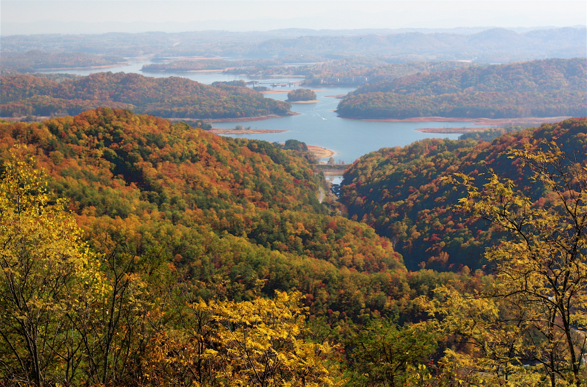
Original Caption: From high atop Clinch Mountain, one can see south across the forested, winding shorelines of Cherokee Lake to the misty Great Smoky Mountains in the distance, a long, serene view of a broad valley with extensive lakes stretching in all directions. This was the route and landscape through which passed the East Tennessee Crossing — the Warriors Path, the Wilderness Road, and the Dixie Highway. Location: Tennessee (36.350° N 83.394° W) Status: Public domain. Photo by Michael Sledjeski |
||||||||||||||||||||||||||
| Date | Taken on 1 November 2008, 14:07 (according to Exif data) | ||||||||||||||||||||||||||
| Collection |
|
||||||||||||||||||||||||||
| Record ID |
|
||||||||||||||||||||||||||
| Source | U.S. National Archives and Records Administration | ||||||||||||||||||||||||||
| Other versions |
Please do not overwrite this file: any restoration work should be uploaded with a new name and linked in this page's "other versions=" parameter, so that this file represents the exact file found in the NARA catalog record to which it links. The metadata on this page was imported directly from NARA's catalog record; additional descriptive text may be added by Wikimedians to the template below with the "description=" parameter, but please do not modify the other fields. |
||||||||||||||||||||||||||
Licensing
This file was provided to Wikimedia Commons by the National Archives and Records Administration as part of a cooperation project. The National Archives and Records Administration provides images depicting American and global history which are public domain or licensed under a free license.
|
This work is in the public domain in the United States because it is a work prepared by an officer or employee of the United States Government as part of that person’s official duties under the terms of Title 17, Chapter 1, Section 105 of the US Code.
Note: This only applies to original works of the Federal Government and not to the work of any individual U.S. state, territory, commonwealth, county, municipality, or any other subdivision. This template also does not apply to postage stamp designs published by the United States Postal Service since 1978. (See § 313.6(C)(1) of Compendium of U.S. Copyright Office Practices). It also does not apply to certain US coins; see The US Mint Terms of Use.
|
 | |
| This file has been identified as being free of known restrictions under copyright law, including all related and neighboring rights. | ||
File history
Click on a date/time to view the file as it appeared at that time.
| Date/Time | Thumbnail | Dimensions | User | Comment | |
|---|---|---|---|---|---|
| current | 18:18, 8 July 2019 | | 2,029 × 1,338 (1.72 MB) | US National Archives bot | Bot-assisted upload of US National Archives Identifer 7718101. |