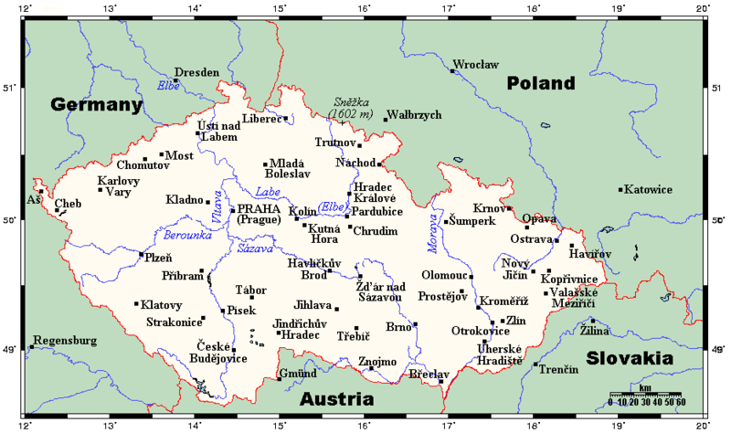
File:CzechRepCitiesTowns.png
Appearance

Size of this preview: 800 × 474 pixels. Other resolutions: 320 × 190 pixels | 640 × 379 pixels | 930 × 551 pixels.
Original file (930 × 551 pixels, file size: 35 KB, MIME type: image/png)
File history
Click on a date/time to view the file as it appeared at that time.
| Date/Time | Thumbnail | Dimensions | User | Comment | |
|---|---|---|---|---|---|
| current | 17:21, 10 February 2012 |  | 930 × 551 (35 KB) | Miaow Miaow | added city of Opava |
| 16:15, 10 February 2012 |  | 930 × 551 (32 KB) | Miaow Miaow | removed Líšeň (presumably a tongue-in-cheek addition by the original creator ?), which is merely a suburb of Brno and of much less importance than other cities depicted | |
| 15:57, 25 March 2009 |  | 930 × 551 (31 KB) | Georgez | {{Information |Description={{en|A map showing the Czech Republic's main cities and towns, and nearby areas in neighbouring countries. This map's source is [http://www.aquarius.ifm-geomar.de/ here], with the uploader's modifications, and the [http://gmt.so |
File usage
The following page uses this file:
Global file usage
The following other wikis use this file:
- Usage on ar.wikipedia.org
- Usage on bs.wikipedia.org
- Usage on el.wikipedia.org
- Usage on ja.wikipedia.org
- Usage on lt.wikipedia.org
- Usage on mk.wikipedia.org
- Usage on pt.wikipedia.org

