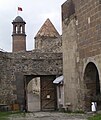
File:Citadel of Erzurum.JPG
Appearance

Size of this preview: 503 × 599 pixels. Other resolutions: 201 × 240 pixels | 403 × 480 pixels | 645 × 768 pixels | 860 × 1,024 pixels | 2,448 × 2,915 pixels.
Original file (2,448 × 2,915 pixels, file size: 1.97 MB, MIME type: image/jpeg)
File history
Click on a date/time to view the file as it appeared at that time.
| Date/Time | Thumbnail | Dimensions | User | Comment | |
|---|---|---|---|---|---|
| current | 23:51, 6 October 2010 |  | 2,448 × 2,915 (1.97 MB) | Bdell555 | {{Information |Description={{en|1=Looking back to the west after entering the area leading to the inner courtyard of the Erzurum Citadel (entrance visible on the right) in eastern Turkey. Elevation 1926 meters.}} |Source={{own}} |Author=Brian Dell [[User |
File usage
No pages on the English Wikipedia use this file (pages on other projects are not listed).
Global file usage
The following other wikis use this file:
- Usage on de.wikipedia.org
- Usage on hy.wikipedia.org
- Usage on hyw.wikipedia.org
- Usage on kk.wikipedia.org
- Usage on pl.wikipedia.org
- Usage on sk.wikipedia.org
- Usage on tr.wikipedia.org
- Usage on www.wikidata.org
