
File:CampParapetMap1863-4.jpg
Size of this preview: 640 × 600 pixels. Other resolutions: 256 × 240 pixels | 820 × 768 pixels | 1,093 × 1,024 pixels | 2,186 × 2,048 pixels | 7,096 × 6,647 pixels.
Original file (7,096 × 6,647 pixels, file size: 64.62 MB, MIME type: image/jpeg)
| This is a file from the Wikimedia Commons. Information from its description page there is shown below. Commons is a freely licensed media file repository. You can help. |
| Description |
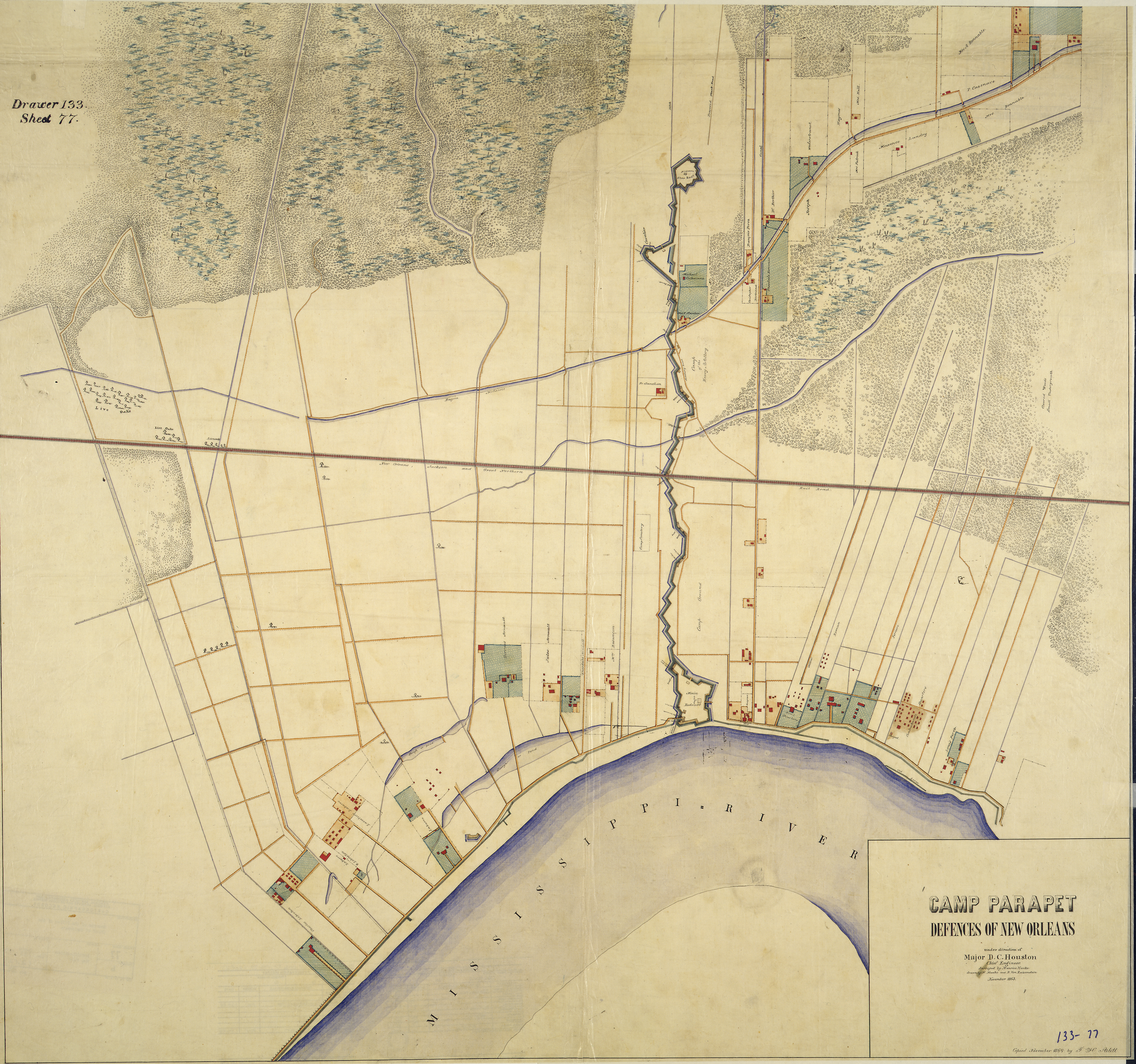
Map of American Civil War forifications upriver from New Orleans, Louisiana. "Camp Parapet [and vicinity], Defences of New Orleans. [Compiled] under direction of Major D. C. Houston, Chief Engineer. Surveyed by Maurice Hauke, drawn by M. Hauke and B. Von Reizenstein, November 1863. Copied November 1864 by F. H. Arlitt." |
||||
| Date | between 1863 and 1864 | ||||
| Source | 1860s map via [1] | ||||
| Author | M. Hauke and B. Von Reizenstein | ||||
| Permission (Reusing this file) |
|
||||
File history
Click on a date/time to view the file as it appeared at that time.
| Date/Time | Thumbnail | Dimensions | User | Comment | |
|---|---|---|---|---|---|
| current | 02:43, 2 February 2010 | | 7,096 × 6,647 (64.62 MB) | Infrogmation | {{Information |Description= Map of American Civil War forifications upriver from New Orleans, Louisiana. "Camp Parapet [and vicinity], Defences of New Orleans. [Compiled] under direction of Major D. C. Houston, Chief Engineer. Surveyed by Maurice Hauke, |
File usage
The following pages on the English Wikipedia use this file (pages on other projects are not listed):