
File:Byzantine Control.png

Size of this preview: 800 × 600 pixels. Other resolutions: 320 × 240 pixels | 640 × 480 pixels | 1,024 × 768 pixels | 1,152 × 864 pixels.
Original file (1,152 × 864 pixels, file size: 55 KB, MIME type: image/png)
| This is a file from the Wikimedia Commons. Information from its description page there is shown below. Commons is a freely licensed media file repository. You can help. |
Summary
| Description |
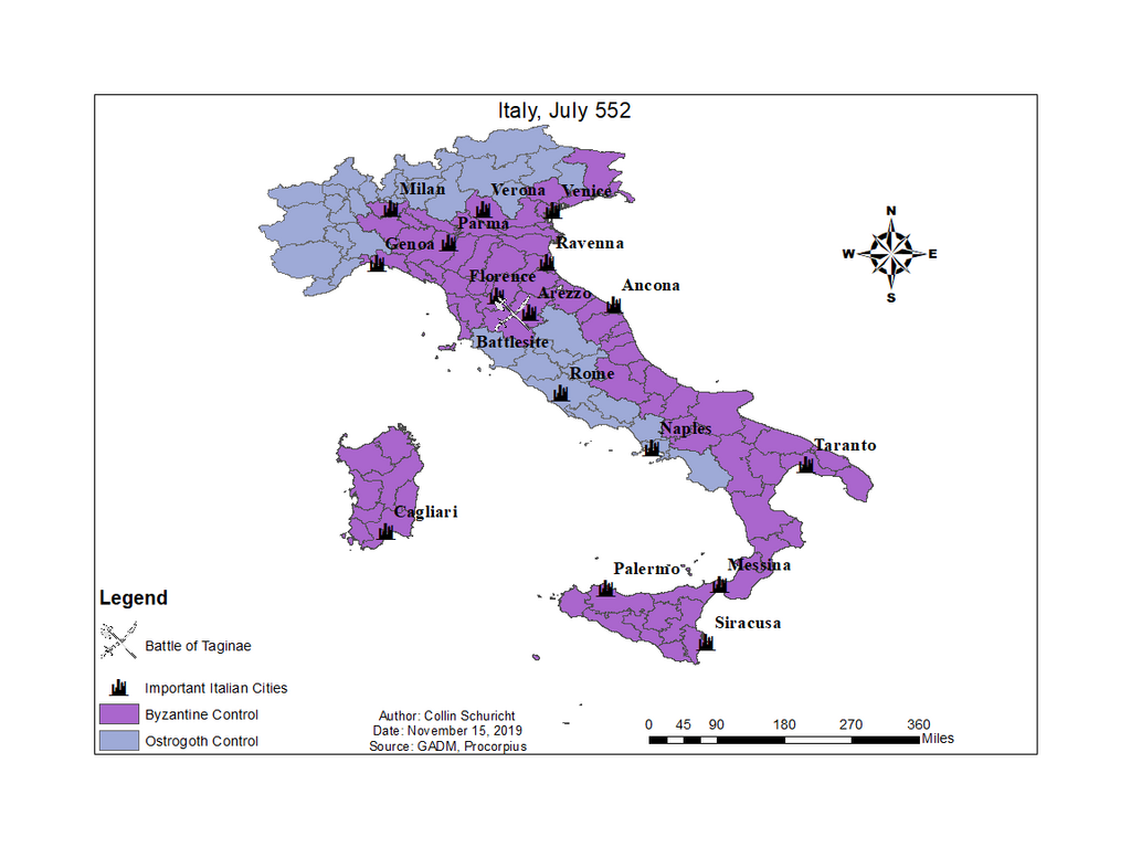
English: This map shows the political situation in Italy during July of 552.It also details the historic Battle of Taginae that saw the Ostrogothic Kingdom cease to exist. The map shows the different control zones of the two opposing factions as well as the major cities of the Italian peninsula as well as Sicily and Sardinia. |
| Date | |
| Source | Own work |
| Author | Collin Schuri |
Licensing
I, the copyright holder of this work, hereby publish it under the following license:
This file is licensed under the Creative Commons Attribution-Share Alike 4.0 International license.
- You are free:
- to share – to copy, distribute and transmit the work
- to remix – to adapt the work
- Under the following conditions:
- attribution – You must give appropriate credit, provide a link to the license, and indicate if changes were made. You may do so in any reasonable manner, but not in any way that suggests the licensor endorses you or your use.
- share alike – If you remix, transform, or build upon the material, you must distribute your contributions under the same or compatible license as the original.
File history
Click on a date/time to view the file as it appeared at that time.
| Date/Time | Thumbnail | Dimensions | User | Comment | |
|---|---|---|---|---|---|
| current | 20:21, 20 November 2019 | | 1,152 × 864 (55 KB) | Collin Schuri | User created page with UploadWizard |
File usage
The following page uses this file:
Global file usage
The following other wikis use this file:
- Usage on fr.wikipedia.org
- Usage on sl.wikipedia.org
- Usage on tr.wikipedia.org