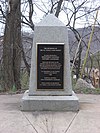
File:Beginning Point of the U.S. Public Land Survey Pennsylvania.jpg
Appearance

Size of this preview: 450 × 600 pixels. Other resolutions: 180 × 240 pixels | 360 × 480 pixels | 576 × 768 pixels | 768 × 1,024 pixels | 2,112 × 2,816 pixels.
Original file (2,112 × 2,816 pixels, file size: 3.32 MB, MIME type: image/jpeg)
File history
Click on a date/time to view the file as it appeared at that time.
| Date/Time | Thumbnail | Dimensions | User | Comment | |
|---|---|---|---|---|---|
| current | 04:30, 28 March 2009 |  | 2,112 × 2,816 (3.32 MB) | Nyttend | {{Location|40|38|33|N|80|31|10|W}} {{Information |Description=View of the Pennsylvania side of the {{w|Beginning Point of the U.S. Public Land Survey}}, a monument marking the site that served as the basis for the entire {{w|Public Land Survey System}} � |
File usage
No pages on the English Wikipedia use this file (pages on other projects are not listed).


