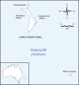
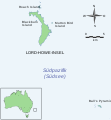
File:Ball's Pyramid and Lord Howe Island map.svg
Appearance

Size of this PNG preview of this SVG file: 512 × 553 pixels. Other resolutions: 222 × 240 pixels | 444 × 480 pixels | 711 × 768 pixels | 948 × 1,024 pixels | 1,896 × 2,048 pixels.
Original file (SVG file, nominally 512 × 553 pixels, file size: 124 KB)
File history
Click on a date/time to view the file as it appeared at that time.
| Date/Time | Thumbnail | Dimensions | User | Comment | |
|---|---|---|---|---|---|
| current | 04:15, 23 November 2021 |  | 512 × 553 (124 KB) | Furfur | == {{int:filedesc}} == {{Information |Description={{User:Medium69/Traduction}} {{de|1=Karte der Lord-Howe-Insel und von Ball’s Pyramid.}} {{en|1=Map of Lord Howe Island and of Ball’s Pyramid.}} |Source={{own}}, with elements from OpenStreetMap, inspired by Priddel, D., Carlile, N., Humphrey M., Fellenberg S., Hiscox D.: Rediscovery of the ‘extinct’ Lord Howe Island stick-insect (''Dryococelus australis'' (Montrouzier)) (Phasmatodea) and recommendations for its conservation. In: Biodiversity a... |
File usage
The following page uses this file:
Global file usage
The following other wikis use this file:
- Usage on de.wikipedia.org
- Usage on fr.wikipedia.org


