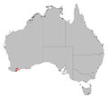
File:B brownii dist map.png
Appearance
B_brownii_dist_map.png (646 × 576 pixels, file size: 61 KB, MIME type: image/png)
File history
Click on a date/time to view the file as it appeared at that time.
| Date/Time | Thumbnail | Dimensions | User | Comment | |
|---|---|---|---|---|---|
| current | 12:28, 29 March 2007 |  | 646 × 576 (61 KB) | Hesperian | Tighter crop on left and right |
| 14:05, 22 December 2006 |  | 800 × 576 (53 KB) | Mahahahaneapneap | pngcrushed | |
| 12:37, 11 August 2006 |  | 800 × 576 (63 KB) | Hesperian | Reverted to earlier revision | |
| 05:43, 3 August 2006 |  | 800 × 576 (63 KB) | Gnangarra | ||
| 12:25, 2 August 2006 |  | 800 × 576 (63 KB) | Gnangarra | ||
| 03:33, 12 July 2006 |  | 800 × 576 (63 KB) | Gnangarra | Distribution map of the Banksia brownii, source for distribution the WA Governemnt Department of Conservation and Land Mmanagement category:Maps by Gnangarra category:Banksia distribution maps |
File usage
The following 2 pages use this file:
Global file usage
The following other wikis use this file:
- Usage on ar.wikipedia.org
- Usage on arz.wikipedia.org
- Usage on ceb.wikipedia.org
- Usage on de.wikipedia.org
- Usage on es.wikipedia.org
- Usage on fi.wikipedia.org
- Usage on fr.wikipedia.org
- Usage on hu.wikipedia.org
- Usage on id.wikipedia.org
- Usage on nl.wikipedia.org
- Usage on pt.wikipedia.org
- Usage on sv.wikipedia.org
- Usage on www.wikidata.org


