
File:Australian Census 2011 demographic map - Inner Sydney by POA - BCP field 1824 Sri Lanka Total.svg

Size of this PNG preview of this SVG file: 800 × 588 pixels. Other resolutions: 320 × 235 pixels | 640 × 471 pixels | 1,024 × 753 pixels | 1,280 × 941 pixels | 2,560 × 1,883 pixels | 2,000 × 1,471 pixels.
Original file (SVG file, nominally 2,000 × 1,471 pixels, file size: 4.07 MB)
| This is a file from the Wikimedia Commons. Information from its description page there is shown below. Commons is a freely licensed media file repository. You can help. |
File history
Click on a date/time to view the file as it appeared at that time.
| Date/Time | Thumbnail | Dimensions | User | Comment | |
|---|---|---|---|---|---|
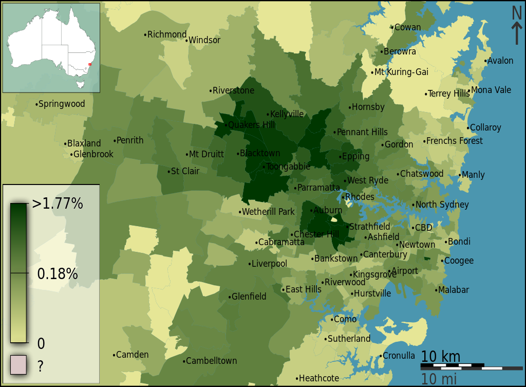
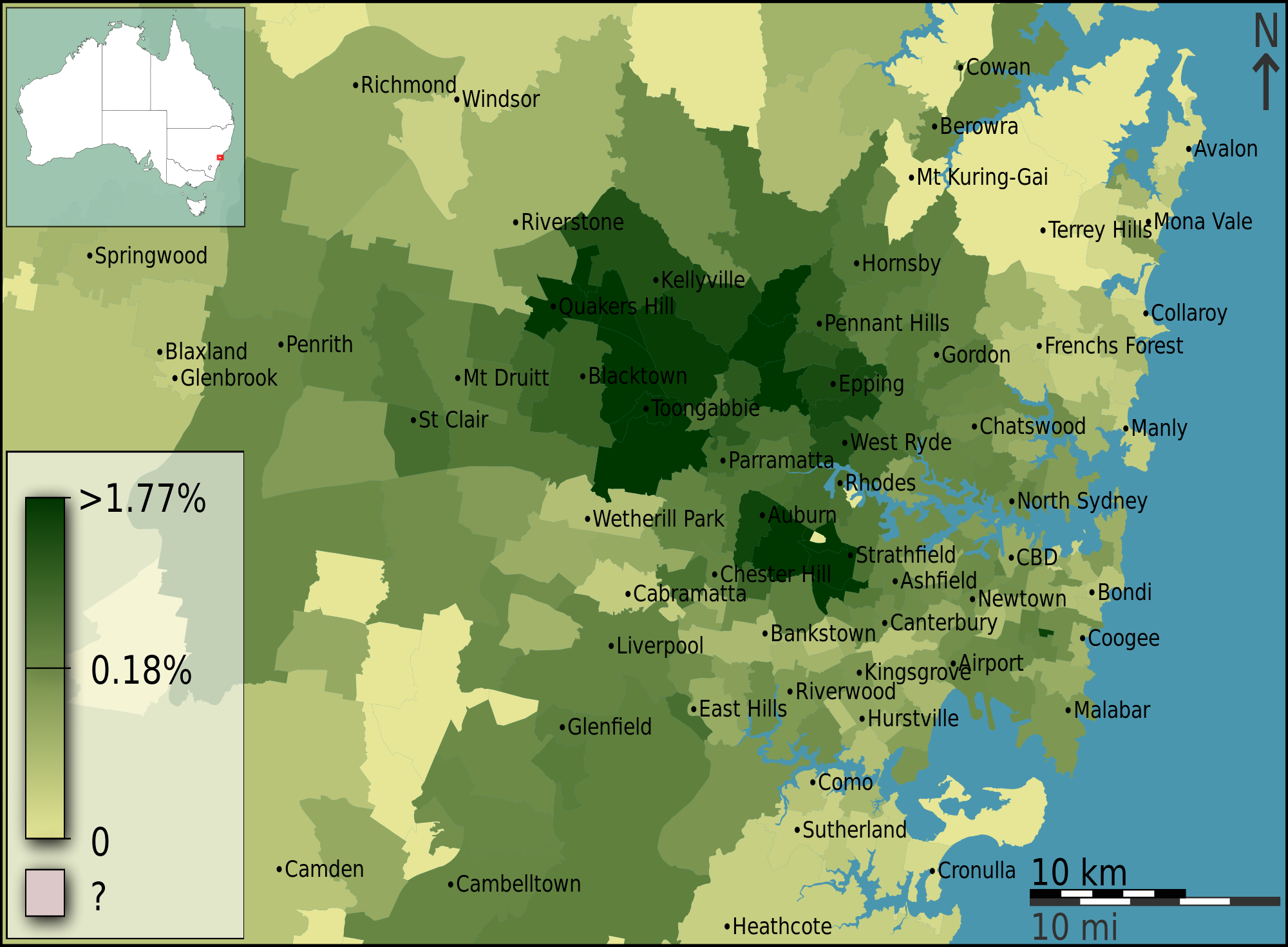
| current | 09:25, 21 June 2013 | | 2,000 × 1,471 (4.07 MB) | File Upload Bot (99of9) | =={{int:filedesc}}== {{Information |Description={{en|{{ucfirst:{{Australian2011CensusMaps/bcpfieldcat/1824}}}} as a fraction of total persons, in Inner Sydney, Australia, according to the 2011 census results. The map is divided into geographical subdiv... |
File usage
The following pages on the English Wikipedia use this file (pages on other projects are not listed):
Global file usage
The following other wikis use this file:
- Usage on si.wikipedia.org