
File:Australia - Map 1879.jpg
Size of this preview: 783 × 599 pixels. Other resolutions: 314 × 240 pixels | 627 × 480 pixels | 1,003 × 768 pixels | 1,280 × 980 pixels | 2,560 × 1,960 pixels | 3,344 × 2,560 pixels.
Original file (3,344 × 2,560 pixels, file size: 5.35 MB, MIME type: image/jpeg)
| This is a file from the Wikimedia Commons. Information from its description page there is shown below. Commons is a freely licensed media file repository. You can help. |
Summary
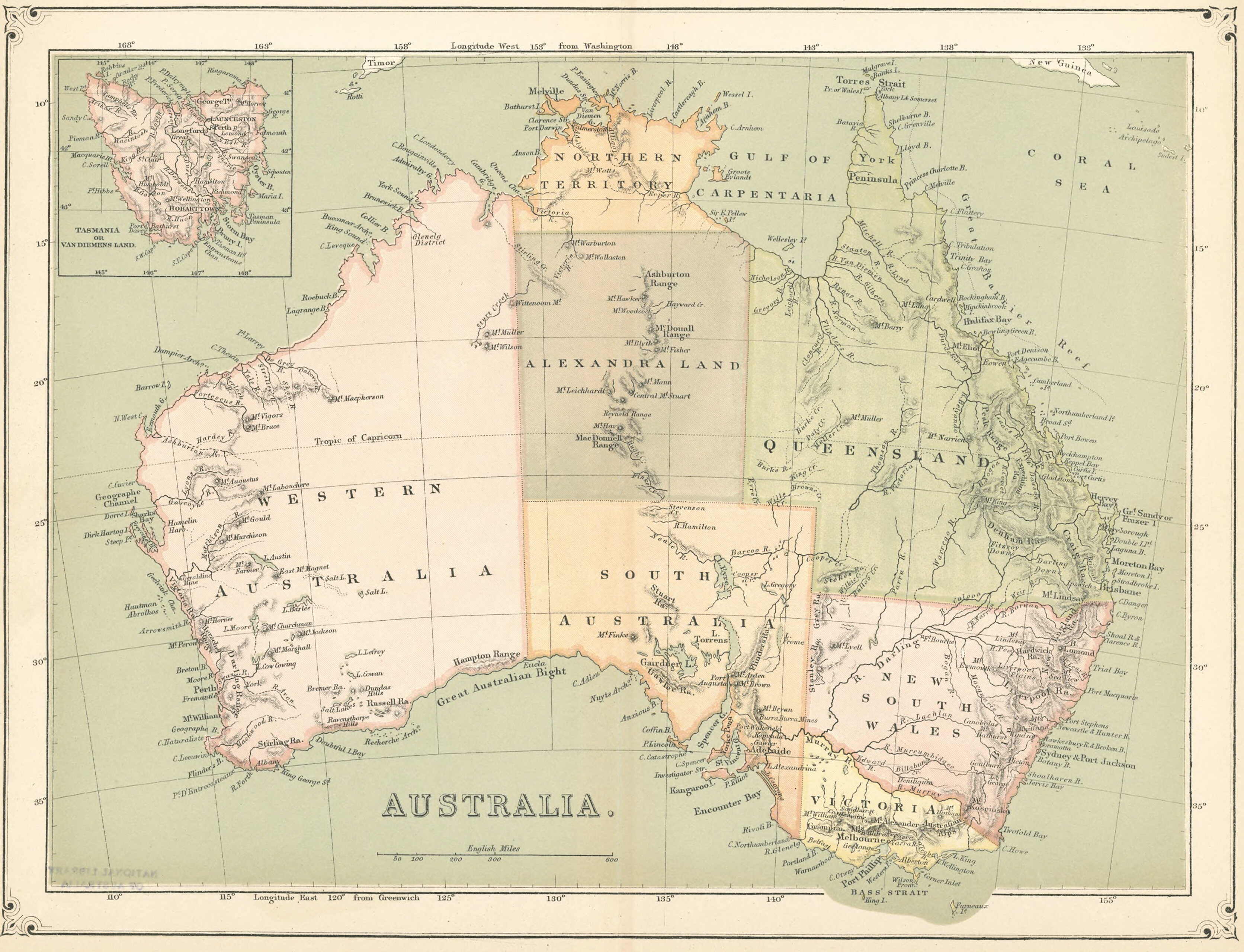
| Description | Map of Australia from 1879 | ||||
| Date | |||||
| Source | National Library of Australia | ||||
| Author | Unknown author | ||||
| Permission (Reusing this file) |
|
||||
File history
Click on a date/time to view the file as it appeared at that time.
| Date/Time | Thumbnail | Dimensions | User | Comment | |
|---|---|---|---|---|---|
| current | 09:07, 18 June 2019 | | 3,344 × 2,560 (5.35 MB) | Oalexander | {{Information |description= Map of Australia from 1879 |date= 1879 |source= [https://nla.gov.au:443/tarkine/nla.obj-232364593 National Library of Australia] |author= {{unknown}} |permission= {{PD-old-70}} |other versions= }} Category:Maps of Australia |
File usage
The following pages on the English Wikipedia use this file (pages on other projects are not listed):
Global file usage
The following other wikis use this file:
- Usage on de.wikipedia.org