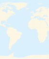
File:Atlantic Ocean location map.svg
Appearance

Size of this PNG preview of this SVG file: 508 × 599 pixels. Other resolutions: 203 × 240 pixels | 407 × 480 pixels | 651 × 768 pixels | 868 × 1,024 pixels | 1,737 × 2,048 pixels | 714 × 842 pixels.
Original file (SVG file, nominally 714 × 842 pixels, file size: 234 KB)
File history
Click on a date/time to view the file as it appeared at that time.
| Date/Time | Thumbnail | Dimensions | User | Comment | |
|---|---|---|---|---|---|
| current | 14:39, 19 March 2010 |  | 714 × 842 (234 KB) | Catrin | Replacing broken Version |
| 14:34, 19 March 2010 | No thumbnail | (126 bytes) | Catrin | {{Information |Description={{de|Positionskarte des Atlantischen Ozeans}} Quadratische Plattkarte. Geographische Begrenzung der Karte: * N: 90° N * S: 81° S * W: 100° W * O: 45° O {{en|Location map of the [[:en:Atlantic Ocean |
File usage
No pages on the English Wikipedia use this file (pages on other projects are not listed).
Global file usage
The following other wikis use this file:
- Usage on ar.wikipedia.org
- ألمانيا
- موريتانيا
- فرنسا
- الصحراء الغربية
- أنغولا
- بلجيكا
- آيسلندا
- إسبانيا
- السنغال
- غامبيا
- غينيا بيساو
- غينيا
- سيراليون
- ليبيريا
- غانا
- توغو
- بنين
- الغابون
- ساحل العاج
- السويد
- البرتغال
- البرازيل
- كندا
- الكاميرون
- الأرجنتين
- جمهورية الكونغو الديمقراطية
- المملكة المتحدة
- جمهورية الكونغو
- ساو تومي وبرينسيب
- ناميبيا
- جمهورية أيرلندا
- الرأس الأخضر
- سورينام
- غيانا
- غينيا الاستوائية
- الجمهورية العربية الصحراوية الديمقراطية
- جرينلاند
- المغرب
- سكان الجمهورية العربية الصحراوية الديمقراطية
- قالب:البلدان والأقاليم المتاخمة للمحيط الأطلسي
- ليبورني
- سفيلاند
- نارك
- فاستمانلاند
- جيش التحرير الشعبي الصحراوي
- Usage on de.wikipedia.org
- Usage on gor.wikipedia.org
- Usage on ia.wiktionary.org
- Usage on it.wikipedia.org
View more global usage of this file.

