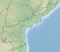
File:India Andhra Pradesh relief map.svg
Appearance

Size of this PNG preview of this SVG file: 725 × 599 pixels. Other resolutions: 290 × 240 pixels | 581 × 480 pixels | 929 × 768 pixels | 1,239 × 1,024 pixels | 2,477 × 2,048 pixels | 1,027 × 849 pixels.
Original file (SVG file, nominally 1,027 × 849 pixels, file size: 1.32 MB)
File history
Click on a date/time to view the file as it appeared at that time.
| Date/Time | Thumbnail | Dimensions | User | Comment | |
|---|---|---|---|---|---|
| current | 17:36, 16 April 2022 |  | 1,027 × 849 (1.32 MB) | C1MM | Updated districts |
| 16:31, 28 December 2021 |  | 1,027 × 849 (1.41 MB) | C1MM | Updated to match location map | |
| 06:05, 7 June 2021 |  | 1,027 × 849 (1.43 MB) | C1MM | Added better relief | |
| 01:17, 17 December 2020 |  | 1,454 × 1,202 (3.1 MB) | C1MM | Changed elevation colours | |
| 04:59, 28 June 2020 |  | 1,454 × 1,202 (4 MB) | C1MM | Fixed colours | |
| 23:03, 25 April 2020 |  | 2,716 × 2,348 (1.72 MB) | C1MM | Fixed whitespace | |
| 23:01, 25 April 2020 |  | 2,716 × 2,348 (1.72 MB) | C1MM | Correct rivers | |
| 03:05, 22 April 2020 |  | 2,716 × 2,348 (1.74 MB) | C1MM | Minor edit to coastline | |
| 02:57, 22 April 2020 |  | 2,716 × 2,348 (1.75 MB) | C1MM | Uploaded a work by Own work based on Milenioscuro from Derivative of File:India Andhra Pradesh location map (current).svg with UploadWizard |
File usage
The following 49 pages use this file:
- 2015 sandalwood smugglers encounter in Andhra Pradesh
- Akkanna Madanna Caves
- Amaravathi, Palnadu district
- Amaravati Stupa
- Andhra Pradesh
- Ardhagiri
- Arma Konda
- Bhattiprolu
- Dharanikota
- Dowleswaram Barrage
- Erramala
- Ethipothala Falls
- Gudivada
- Gundla Brahmeswaram Wildlife Sanctuary
- Gundlakamma Reservoir Project
- Gundlakamma River
- Guntupalli Group of Buddhist Monuments
- Hanuman Junction
- Jaggayyapeta
- Jalaput Dam
- Kalyani Dam
- Kolleru Lake
- Konaseema
- Kotturu Dhanadibbalu
- Lanka Sagar Dam
- Mogalrajapuram Caves
- Nagarjuna Sagar Dam
- Nallamala Hills
- Nellore
- Pothireddypadu Reservoir
- Prakasam Barrage
- Pulicat Lake
- Pulichinthala Project
- Raiwada Reservoir
- Sanjeevaiah Sagar
- Sapthagiri
- Shahi Jamia Mosque
- Somasila Dam
- Sri Venkateswara National Park
- Srisailam Dam
- Sunkesula Barrage
- Tatipudi Reservoir
- Thotapalli Barrage
- Veligallu Dam Reservoir
- Veligonda Project
- Venkata (hill)
- Module:Location map/data/India Andhra Pradesh
- Module:Location map/data/India Andhra Pradesh/doc
- Module:Location map/data/India Andhra Pradesh/sandbox
Global file usage
The following other wikis use this file:
- Usage on ar.wikipedia.org
- Usage on de.wikipedia.org
- Usage on eo.wikipedia.org
- Andra-Pradeŝo
- Viŝakhapatnam
- Viĝajavado
- Naturrezervejo Poĉaram
- Kolleru
- Naturrezervejo Kriŝna
- Ŝablono:Situo sur mapo Barato Andra-Pradeŝo
- Tirupati
- Moparru
- Tenali
- Nellore
- Amaravatio
- Kurnul
- Kakinada
- Raĝamahendravaram
- Kadapa
- Mangalagiri
- Adoni (Barato)
- Anantapur
- Proddatur
- Guntakal
- Nandjal
- Tadipatri
- Vizianagaram
- Eluru
- Ongole
- Madanapalle
- Maĉilipatnam
- Hindupur
- Srikakulam
- Bhimavaram
- Tadepalligudem
- Dharmavaram
- Gudivada
- Kadiri
- Narasaraopet
- Ĉilakaluripet
- Ĉittur
- Usage on es.wikipedia.org
- Usage on fr.wikipedia.org
View more global usage of this file.
