
File:AlvsborgsFastning1899.jpg
Size of this preview: 564 × 600 pixels. Other resolutions: 226 × 240 pixels | 452 × 480 pixels | 722 × 768 pixels | 963 × 1,024 pixels | 2,333 × 2,480 pixels.
Original file (2,333 × 2,480 pixels, file size: 811 KB, MIME type: image/jpeg)
| This is a file from the Wikimedia Commons. Information from its description page there is shown below. Commons is a freely licensed media file repository. You can help. |
Summary
| Description |
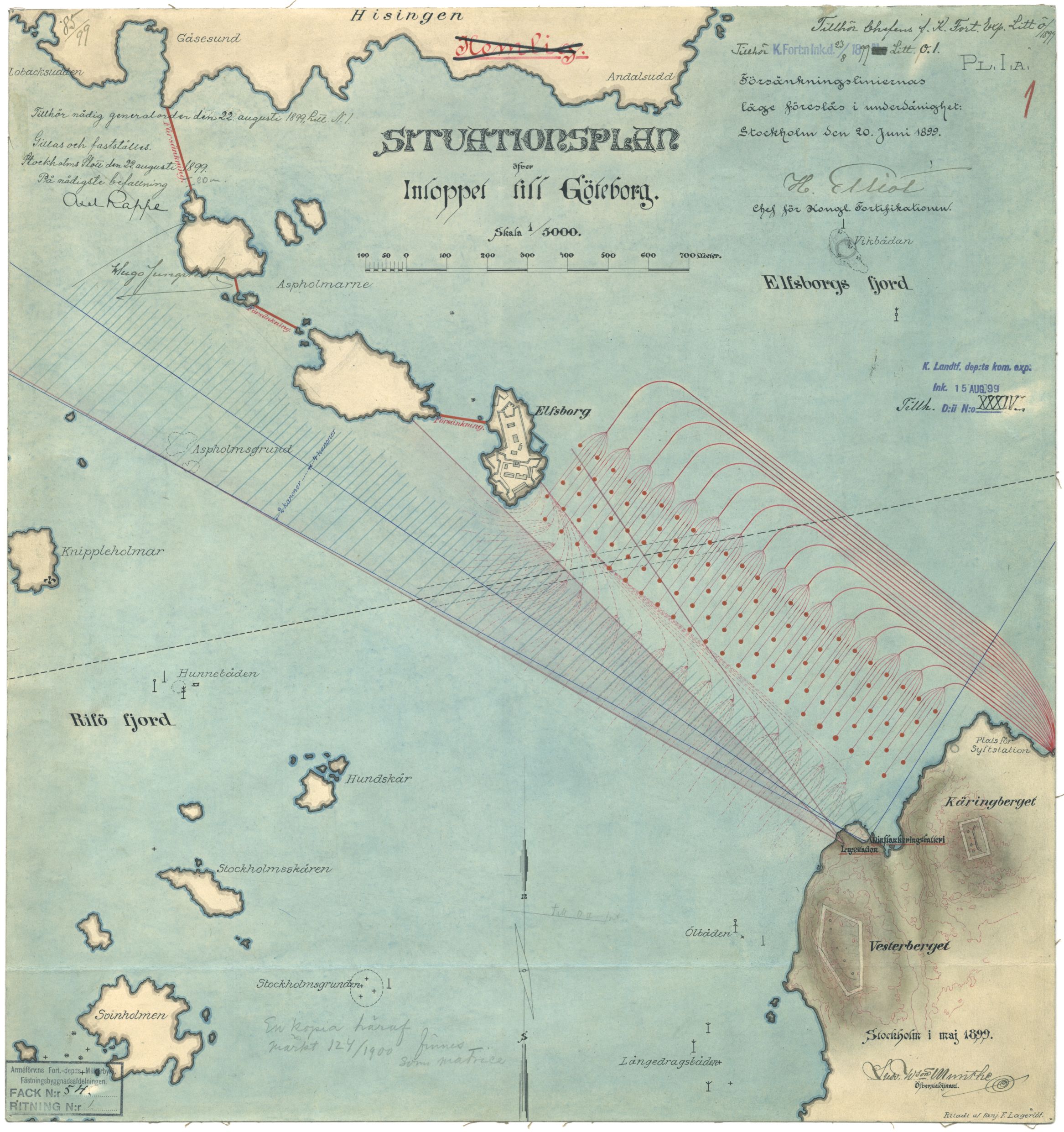
English: Declassified map showing the entrance to Gothenburg harbour, with planned defences 1899.
Svenska: Tidigare hemligstämplad karta över inloppet till Göteborgs hamn med planerade försvarsåtgärder år 1899, vilket senare blev Älvsborgs Fästning (ÄF). |
| Date | |
| Source | Krigsarkivet: Armeförvaltningen, Fortifikations departementet Fack 54 Ritning nr1 |
| Author | F. Lagerlöf |
Licensing
|
This work is in the public domain in its country of origin and other countries and areas where the copyright term is the author's life plus 70 years or fewer. | |
| This file has been identified as being free of known restrictions under copyright law, including all related and neighboring rights. | |
File history
Click on a date/time to view the file as it appeared at that time.
| Date/Time | Thumbnail | Dimensions | User | Comment | |
|---|---|---|---|---|---|
| current | 17:11, 25 August 2013 | | 2,333 × 2,480 (811 KB) | Dagjoh | {{Information |Description ={{en|1=Declassified map showing the entrance to Gothenburg harbour, with planned defences 1899.}} {{sv|1=Tidigare hemligstämplad karta över inloppet till Göteborgs hamn med planerade försvarsåtgärder år 1899, vilke... |
File usage
The following pages on the English Wikipedia use this file (pages on other projects are not listed):
Global file usage
The following other wikis use this file:
- Usage on sv.wikipedia.org