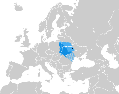
File:Alex K Halych-Volhynia general.png
Appearance
Alex_K_Halych-Volhynia_general.png (440 × 365 pixels, file size: 38 KB, MIME type: image/png)
File history
Click on a date/time to view the file as it appeared at that time.
| Date/Time | Thumbnail | Dimensions | User | Comment | |
|---|---|---|---|---|---|
| current | 17:40, 3 November 2024 |  | 440 × 365 (38 KB) | Iktsokh | Clearing the map at the borders |
| 16:31, 29 January 2022 |  | 462 × 365 (43 KB) | Moodylo333 | Reverted to version as of 03:41, 19 August 2007 (UTC): COM:CROP | |
| 15:58, 19 February 2019 |  | 462 × 365 (41 KB) | Augustus-ua | Уточнено кордони за Темушев Н. В. Вялікае княства Літоўскае: Энцыклапедыя; Лоза І. Історичний Атлас України, Вортман Д. на likbez.org.ua | |
| 18:40, 17 January 2019 |  | 462 × 365 (44 KB) | Claude Zygiel | Without soviet dams; Montenegro; maximal extension lighter, influence area bluebordered, since Grosser Atlas zur Weltgeschichte, Westermann 1985 - ISBN 3-14-100919-8; Putzger historischer Weltatlas, Cornelsen 1990 - ISBN 3-464-00176-8 and Atlas historique Georges Duby, Larousse Paris 1987 - ISBN 2-03-503009-9. | |
| 03:41, 19 August 2007 |  | 462 × 365 (43 KB) | Alex Tora | {{Information |Description=Карта Галицько-Волинського князівства |Source=self-made =* [http://litopys.org.ua/krypgvol/krypgv03.htm Крип'якевич І. |
File usage
The following 3 pages use this file:
Global file usage
The following other wikis use this file:
- Usage on ar.wikipedia.org
- Usage on ast.wikipedia.org
- Usage on az.wikipedia.org
- Usage on ba.wikipedia.org
- Usage on bg.wikipedia.org
- Usage on da.wikipedia.org
- Usage on de.wikipedia.org
- Usage on el.wikipedia.org
- Usage on es.wikipedia.org
- Usage on et.wikipedia.org
- Usage on eu.wikipedia.org
- Usage on fi.wikipedia.org
- Usage on fr.wikipedia.org
- Usage on gl.wikipedia.org
- Usage on he.wikipedia.org
- Usage on hy.wikipedia.org
- Usage on ja.wikipedia.org
- Usage on la.wikipedia.org
- Usage on lt.wikipedia.org
- Usage on lv.wikipedia.org
- Usage on mk.wikipedia.org
- Usage on nl.wikipedia.org
- Usage on pl.wikipedia.org
- Usage on ru.wikipedia.org
- Usage on ru.wikiversity.org
- Usage on sr.wikipedia.org
- Украјина
- Химна Украјине
- Списак градова у Украјини
- Кијев
- Оружане снаге Украјине
- Копнена војска Украјине
- Војно-поморске снаге Украјине
- Шаблон:Теме Украјине
- Украјинска устаничка армија
- Украјинска музика
- Државни празници у Украјини
- Култура Украјине
- Привреда Украјине
- Украјинска кухиња
- Википедија:Акција писања чланака на тему Украјине и Русије/Чланци
View more global usage of this file.


