
File:Adwa map.jpg
Size of this preview: 437 × 599 pixels. Other resolutions: 175 × 240 pixels | 350 × 480 pixels | 709 × 972 pixels.
Original file (709 × 972 pixels, file size: 134 KB, MIME type: image/jpeg)
| This is a file from the Wikimedia Commons. Information from its description page there is shown below. Commons is a freely licensed media file repository. You can help. |
Summary
| Description |
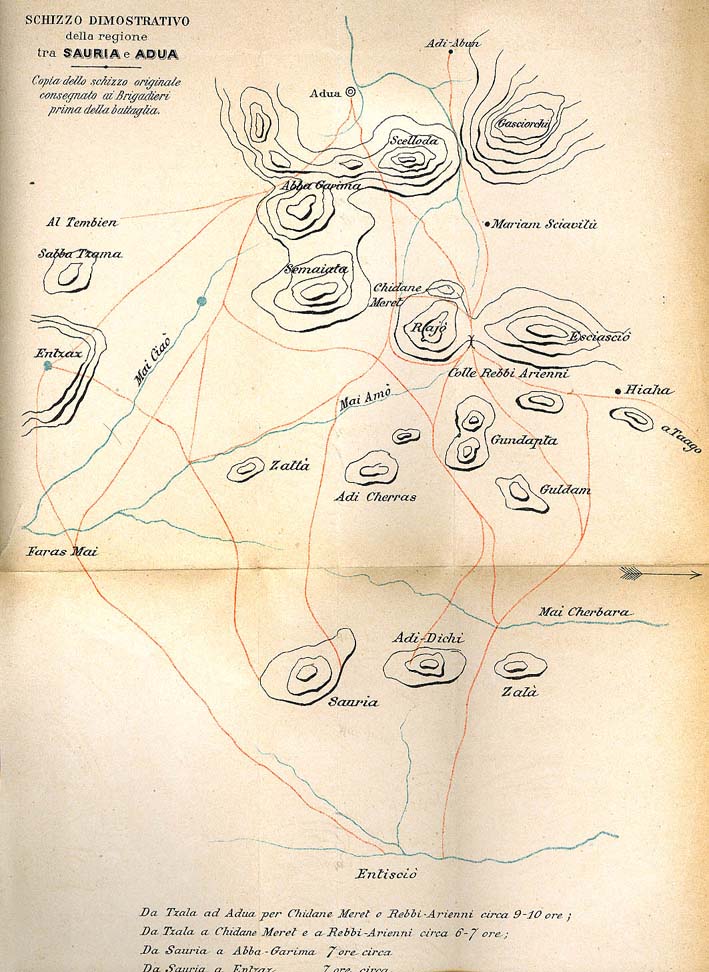
English: An 1890s Italian map of Adwa or Adua |
| Date | 1890s |
| Source | http://www.ilcornodafrica.it/st-adua.htm |
| Author | Da O. Baratieri, Memorie d’Africa (1892-1896), Torino, Fratelli Bocca, 1898 (l’orientamento della mappa ha l’Ovest in alto) |
Licensing
|
This work is in the public domain in its country of origin and other countries and areas where the copyright term is the author's life plus 70 years or fewer. | |
| This file has been identified as being free of known restrictions under copyright law, including all related and neighboring rights. | |
File history
Click on a date/time to view the file as it appeared at that time.
| Date/Time | Thumbnail | Dimensions | User | Comment | |
|---|---|---|---|---|---|
| current | 13:23, 30 September 2009 | | 709 × 972 (134 KB) | Himalayan Explorer | {{Information |Description={{en|1=h}} |Source=h |Author=h |Date=h |Permission= |other_versions= }} |
File usage
The following pages on the English Wikipedia use this file (pages on other projects are not listed):
Global file usage
The following other wikis use this file:
- Usage on azb.wikipedia.org
- Usage on ca.wikipedia.org
- Usage on de.wikivoyage.org
- Usage on en.wikivoyage.org
- Usage on fr.wikipedia.org
- Usage on lmo.wikipedia.org
- Usage on no.wikipedia.org
- Usage on www.wikidata.org
- Usage on zh.wikipedia.org