Jump to content

File:Adamov (Č.Budějovice) čp39.jpg

Page contents not supported in other languages.
This is a file from the Wikimedia Commons
From Wikipedia, the free encyclopedia

Original file (3,316 × 2,736 pixels, file size: 1.36 MB, MIME type: image/jpeg)

Description
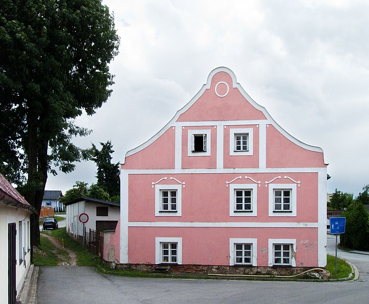
English: House No 39 in the village of Adamov, České Budějovice District, Czech Republic - former town hall.
Čeština: Dům č.p. 39 v obci Adamov v okrese České Budějovice - bývalá radnice.
Date
Source

Own work

This is a photo of a cultural monument of the Czech Republic,
number:

44591/3-1.
Památkový katalog  · MIS  · hledat obrázky  · hledat seznamy  · Wikidata

Author Czeva
Permission
(Reusing this file)
Při použití fotografie mimo Wikipedie nutno uvést mé jméno/ Photo can only be used outside Wikipedia with my name
Camera location48° 59′ 57.9″ N, 14° 32′ 26.29″ E  Heading=180° Kartographer map based on OpenStreetMap.View this and other nearby images on: OpenStreetMapinfo
This photograph was taken within the scope of the third year of the 'Czech Municipalities Photographs' grant.

čeština | English | español | français | македонски | slovenčina | српски / srpski | +/−

I, the copyright holder of this work, hereby publish it under the following license:
w:en:Creative Commons
attribution share alike
This file is licensed under the Creative Commons Attribution-Share Alike 3.0 Unported license.
You are free:
  • to share – to copy, distribute and transmit the work
  • to remix – to adapt the work
Under the following conditions:
  • attribution – You must give appropriate credit, provide a link to the license, and indicate if changes were made. You may do so in any reasonable manner, but not in any way that suggests the licensor endorses you or your use.
  • share alike – If you remix, transform, or build upon the material, you must distribute your contributions under the same or compatible license as the original.

Captions

Add a one-line explanation of what this file represents

Elementos representados en este archivo

depicts

2 July 2011

48°59'57.901"N, 14°32'26.290"E

heading: 180 degree

0.0008 second

5.6 millimetre

image/jpeg

1eb18c99cf4053866a316ca580fead97ea0f6528

1,423,453 byte

2,736 pixel

3,316 pixel

File history

Click on a date/time to view the file as it appeared at that time.

Date/TimeThumbnailDimensionsUserComment
current16:11, 4 July 2011Thumbnail for version as of 16:11, 4 July 20113,316 × 2,736 (1.36 MB)Czeva

The following page uses this file:

Global file usage

The following other wikis use this file:

Metadata